Karoonda, South Australia
| Karoonda South Australia | |||||||||||||||
|---|---|---|---|---|---|---|---|---|---|---|---|---|---|---|---|
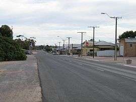 Main Street of Karoonda | |||||||||||||||
 Karoonda | |||||||||||||||
| Coordinates | 35°05′40″S 139°53′45″E / 35.094459°S 139.895888°ECoordinates: 35°05′40″S 139°53′45″E / 35.094459°S 139.895888°E[1] | ||||||||||||||
| Population |
| ||||||||||||||
| Established |
11 December 1913 (town) 11 November 1999 (locality)[4][1][5] | ||||||||||||||
| Postcode(s) | 5307[6] | ||||||||||||||
| Time zone | ACST (UTC+9:30) | ||||||||||||||
| • Summer (DST) | ACDT (UTC+10:30) | ||||||||||||||
| Location | 119 km (74 mi) E of Adelaide | ||||||||||||||
| LGA(s) | District Council of Karoonda East Murray | ||||||||||||||
| Region | Murray and Mallee[1] | ||||||||||||||
| County | Buccleuch[1] | ||||||||||||||
| State electorate(s) | Hammond[7] | ||||||||||||||
| Federal Division(s) | Barker[8] | ||||||||||||||
| |||||||||||||||
| |||||||||||||||
| Footnotes | Adjoining localities[1] | ||||||||||||||
Karoonda is in the middle of the Murray Mallee region of South Australia (60 km northeast of Murray Bridge). Karoonda takes its name from the Aboriginal word for "winter camp". The current boundaries include the former town of Lowaldie, which was the next stop on the railway line away from Adelaide.
At the 2016 census, the locality of Karoonda had a population of 512 of which 351 were living in and around the town of Karoonda.[3][2][1]
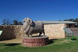
Karoonda was founded on wheat growing early in the 20th century (proclaimed on 11 December 1913), but the cleared land is also suitable for raising merino sheep. The Karoonda Development Group instigated and built a larger-than-life sculpture of a Merino ram in the park in the main street to emphasise this. There are even seats with rams heads dotted around the town. A number of other agricultural and horticultural industries are now also represented in the district. Each year the Karoonda Farm Fair is held, a two-day event attracting over 10,000 visitors to the town.
Karoonda briefly shot to international fame in 1930 when a meteorite fell to earth just to the east of the town on the night of 25 November.
Karoonda Area School was the first area school in South Australia.
Karoonda is located in the local government area of District Council of Karoonda East Murray, the state electoral district of Hammond and the federal Division of Barker.[8][7][1]
Pioneer Park on East Terrace is being developed as a Malleelands Pioneer Railways and farm museum, with displays of harvest machinery, plows, railway rolling stock and facilities already in place. The Nature Trail & Bush Walk is adjacent.
Railways
Railways were built in 1911-1914 to open up the mallee. Karoonda was on the Brown's Well railway line (extended to Barmera in 1928) and became a junction with the Waikerie railway line to the north and the Peebinga railway line to the east (south of the main line).[10] Both branches were closed in 1990, but the main line through Karoonda remains open as the Loxton railway line and was converted from broad gauge to standard gauge.
Lowaldie
The Lowaldie railway station was 6.25 miles (10.06 km) east of Karoonda and also had a small town surveyed, with a school and post office operating for some time. These have all closed, and the former institute building is used as a private residence. The station was originally named Lowalde in 1913, but when the town was proclaimed in 1914, the spelling used was Lowaldie. The name is derived from a Ngarrindjeri word meaning summer.[11][12]
Photo gallery
| Wikimedia Commons has media related to Karoonda, South Australia. |
 Post Office
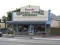 General Store
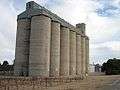 ABB Silos
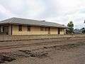 Old Railway Station
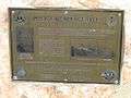 Police Memorial, Railway Tce
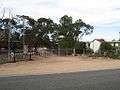 Lions Pioneer Park
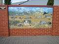 Painting at Parking Bay
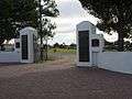 Memorial Gates at the Oval
 Obelisk
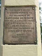 Obelisk
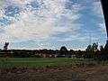 Area School
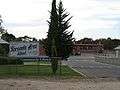 Area School
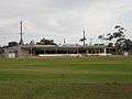 Oval
Oval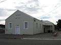 Institute
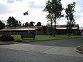 Hospital
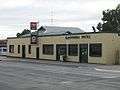 Karoonda Pub
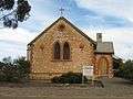 "All Hallows" Anglican Church
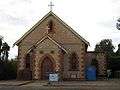 St Finian's Catholic Church
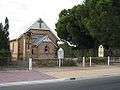 St Johns Lutheran Church
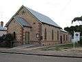 Uniting Church
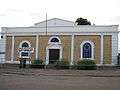 Op-Shop
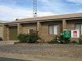 Ambulance Station
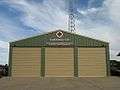 CFS Station
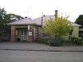 Police Station
References
- 1 2 3 4 5 6 7 "Search results for 'Karoonda, LOCB' with the following datasets being selected - 'Suburbs and Localities', 'Government Towns', 'Counties', 'Local Government Areas', 'SA Government Regions', 'Railways' and 'Gazetteer'". Location SA Map Viewer. Government of South Australia. Retrieved 6 May 2018.
- 1 2 Australian Bureau of Statistics (27 June 2017). "Karoonda (urban centre)". 2016 Census QuickStats. Retrieved 7 May 2018.

- 1 2 Australian Bureau of Statistics (27 June 2017). "Karoonda (locality)". 2016 Census QuickStats. Retrieved 7 May 2018.
- ↑ Bice, John G. (11 December 1913). "TOWN OF KAROONDA" (PDF). The South Australian Government Gazette. Government of South Australia: 1678. Retrieved 6 May 2018.
- ↑ Kentish, P.M. (11 November 1999). "GEOGRAPHICAL NAMES ACT 1991 Notice to Assign Boundaries to Places (in the District Council of Karoonda East Murray)" (PDF). The South Australian Government Gazette. South Australian Government. p. 2321. Retrieved 5 May 2018.
- ↑ "Postcode for Karoonda, South Australia". Postcodes Australia. Retrieved 9 May 2018.
- 1 2 "District of Hammond (map)". Electoral Commission SA. Retrieved 4 May 2018.
- 1 2 "Federal electoral division of Barker, boundary gazetted 16 December 2011" (PDF). Australian Electoral Commission. Retrieved 17 September 2015.
- 1 2 3 "Summary (climate) statistics KAROONDA (nearest weather station)". Commonwealth of Australia, Bureau of Meteorology. Retrieved 4 May 2018.
- ↑ Rail Line to Nowhere Southwell, J.G. Australian Railway Historical Society Bulletin, July, 1971 pp146-151
- ↑ Bice, John G. (2 April 1914). "TOWNS OF BORRIKA AND LOWALDIE" (PDF). The South Australian Government Gazette. Government of South Australia: 810. Retrieved 6 May 2018.
- ↑ "Placename Details: Lowaldie". Property Location Browser. Government of South Australia. 12 May 2011. Retrieved 12 February 2016.
Narinyeri word meaning summer. Town surveyed in November 1913. Name altered when the town was proclaimed - no indication is given on the glossary card as to the name originally proposed but old cards show Lowalde. Town diminished in February 1938. Now incorporated into the bounded locality of Karoonda.