York Township, Benton County, Indiana
| York Township | |
|---|---|
| Township | |
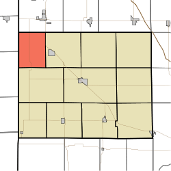 Location of York Township in Benton County | |
| Coordinates: 40°42′03″N 87°29′03″W / 40.70083°N 87.48417°WCoordinates: 40°42′03″N 87°29′03″W / 40.70083°N 87.48417°W | |
| Country | United States |
| State | Indiana |
| County | Benton |
| Organized | June 1860 |
| Government | |
| • Type | Indiana township |
| Area | |
| • Total | 27.5 sq mi (71 km2) |
| • Land | 27.49 sq mi (71.2 km2) |
| • Water | 0 sq mi (0 km2) |
| Elevation[1] | 771 ft (235 m) |
| Population (2010) | |
| • Total | 181 |
| • Density | 6.6/sq mi (2.5/km2) |
| Time zone | UTC-5 (EST) |
| • Summer (DST) | UTC-4 (EDT) |
| FIPS code | 18-85940[2] |
| GNIS feature ID | 454066 |
York Township is one of eleven townships in Benton County, Indiana. As of the 2010 census, its population was 181 and it contained 84 housing units.[3] It was organized in June 1860 and named for the state of New York, the former home of local pioneer John Fleming.[4]
Geography
According to the 2010 census, the township has a total area of 27.5 square miles (71 km2), all land.[3]
Unincorporated towns
Adjacent townships
- Parish Grove (south)
- Richland (east)
- Jefferson Township, Newton County (north)
Major highways
Cemeteries
The township contains two cemeteries: Blue Ridge and Fleming.
References
- ↑ "US Board on Geographic Names". United States Geological Survey. 2007-10-25. Retrieved 2008-01-31.
- ↑ "American FactFinder". United States Census Bureau. Archived from the original on September 11, 2013. Retrieved 2008-01-31.
- 1 2 "Population, Housing Units, Area, and Density: 2010 - County -- County Subdivision and Place -- 2010 Census Summary File 1". United States Census. Retrieved 2013-05-10.
- ↑ Birch, Jesse Setlington (1942) [1928]. History of Benton County and Historic Oxford. Oxford, Indiana: Craw & Craw, Inc. p. 21.
External links
Municipalities and communities of Benton County, Indiana, United States | ||
|---|---|---|
| Towns | ||
| Townships | ||
| Unincorporated communities | ||
| Footnotes | ‡This populated place also has portions in an adjacent county or counties | |
This article is issued from
Wikipedia.
The text is licensed under Creative Commons - Attribution - Sharealike.
Additional terms may apply for the media files.