Yongdae Gap
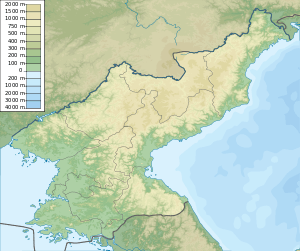 Position of Yongdae Gap in North Korea | |
| Location |
Yongdae Gap South Hamgyong Province North Korea |
|---|---|
| Coordinates | 40°28′24.8″N 129°3′44.2″E / 40.473556°N 129.062278°E[1] |
| Year first constructed | n/a |
| Tower shape | cylindrical tower with balcony and lantern |
| Markings / pattern | white tower |
| Focal height | 61 meters (200 ft)[1] |
| Range | 12 nautical miles (22 km; 14 mi)[1] |
| Characteristic | L Fl W 9s.[1] |
| Admiralty number | M4514[1] |
| NGA number | 16301[1] |
Yongdae Gap[2] (Korean: 용대갑, 龍台岬, "Dragon-Terrace Cape") is a North Korean headland in the middle of the country's eastern coast along the Sea of Japan. It forms the southeastern corner of South Hamgyong's Danchon County and the western point of a narrow bay sheltering Songjin and Hwadae.
Names
In the 19th century, Yongdae Gap was known as Cape Schlippenbach or Schlippenback.[3] During the Japanese occupation of Korea, it was known as Ryūdai-kō.
Geography
Yongdae Gap is the southern point of a small peninsula whose most conspicuous summit is Wonsandok San, which rises to an elevation of 504 meters (1,654 ft) about 4 miles (6.4 km) due north of the cape. The highest visible mountain from the point is Yongyon San, which rises to an elevation of 1,598 meters (5,243 ft) about 17 miles (27 km) farther NNW. Its range extends 25 miles (40 km) north from the cape.[2]
A half-mile (.8 km) to the west of the peninsula is Yongdae Myoji ("Yongdae Anchorage").[2] This has a depth of 9.1–13 meters (30–43 ft) and bottom in fine sand, but is unsafe except as a shelter from NE winds.[2]
To the east of Yongdae Gap is a narrow but long and deep bay[3] extending about 40 miles (64 km) east to Musu Point.
Lighthouse
Yongdae Gap has a lighthouse, but it is closed to the public[4] and the American National Geospatial-Intelligence Agency notes that "the existence and operation of all navigational aids should be considered unreliable on the east coast of North Korea".[1]
See also
- Yongdae, its namesake village
- List of lighthouses in North Korea
References
Citations
- 1 2 3 4 5 6 7 NGA (2016), p. 213.
- 1 2 3 4 MSO (2015), p. 73.
- 1 2 Jarrad (1884), p. 137.
- ↑ Rowlett (2007).
Bibliography
- "Coasts of Korea and China" (PDF), Sailing Directions, Pub. 157, Springfield: Maritime Safety Office of the National Geospatial-Intelligence Agency, 2015 .
- List of Lights, Pub. 112: Western Pacific and Indian Oceans Including the Persian Gulf and Red Sea (PDF). List of Lights. United States National Geospatial-Intelligence Agency. 2016.
- Jarrad, Frederick W. (1884), The China Sea Directory, Vol. IV: Coasts of Korea, Russian Tartary, the Japan Islands, Gulfs of Tartary and Amùr, and the Sea of Okhotsk, London: J.D. Potter for the Hydrographic Office of the Admiralty .
- Rowlett, Russ (2007), "Lighthouses of Eastern North Korea", The Lighthouse Directory, Chapel Hill: University of North Carolina .
External links
- "NK 52-11: Sōngjin", AMS Series L552, Washington: Army Map Service, 1954 , a topographical map of the area around Yongdae Gap.
Coordinates: 40°28′35″N 129°04′02″E / 40.4763745°N 129.0671542°E