Yantley, Alabama
| Yantley | |
|---|---|
| Unincorporated community | |
 Yantley Yantley's position in Alabama. | |
| Coordinates: 32°14′46″N 88°22′46″W / 32.24611°N 88.37944°WCoordinates: 32°14′46″N 88°22′46″W / 32.24611°N 88.37944°W | |
| Country |
|
| State |
|
| County | Choctaw |
| Elevation | 85 m (279 ft) |
| Time zone | UTC-6 (Central (CST)) |
| • Summer (DST) | UTC-5 (CDT) |
| GNIS feature ID | 154042 |
| U.S. Geological Survey Geographic Names Information System: Yantley, Alabama | |
Yantley is an unincorporated community in Choctaw County, Alabama, United States.[1] On April 27, 2011, a tornado hit Yantley, knocking down trees and power lines, and causing structural damage, as part of the 2011 Super Outbreak.[2]
References
- ↑ "Feature Detail Report for: Yantley, Alabama." USGS. U.S. Geological Survey Geographic Names Information System: Yantley, Alabama Retrieved April 28, 2011.
- ↑ NOAA Report
Municipalities and communities of Choctaw County, Alabama, United States | ||
|---|---|---|
| Towns | 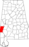 | |
| CDP | ||
| Unincorporated communities | ||
| Footnotes | ‡This populated place also has portions in an adjacent county or counties | |
This article is issued from
Wikipedia.
The text is licensed under Creative Commons - Attribution - Sharealike.
Additional terms may apply for the media files.