Yamaska, Quebec
| Yamaska | |
|---|---|
| Municipality | |
 | |
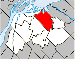 Location within Pierre-De Saurel RCM | |
 Yamaska Location in southern Quebec | |
| Coordinates: 46°00′N 72°55′W / 46°N 72.92°WCoordinates: 46°00′N 72°55′W / 46°N 72.92°W[1] | |
| Country |
|
| Province |
|
| Region | Montérégie |
| RCM | Pierre-De Saurel |
| Constituted | December 19, 2001 |
| Government[2][3] | |
| • Mayor | Louis R. Joyal |
| • Federal riding | Bécancour—Nicolet—Saurel |
| • Prov. riding | Richelieu |
| Area[2][4] | |
| • Total | 76.60 km2 (29.58 sq mi) |
| • Land | 73.04 km2 (28.20 sq mi) |
| Population (2011)[4] | |
| • Total | 1,644 |
| • Density | 22.5/km2 (58/sq mi) |
| • Pop 2006-2011 |
|
| • Dwellings | 939 |
| Time zone | UTC−5 (EST) |
| • Summer (DST) | UTC−4 (EDT) |
| Postal code(s) | J0G 1X0 |
| Area code(s) | 450 and 579 |
| Highways |
|
| Website |
www |
Yamaska is a municipality in the Pierre-De Saurel Regional County Municipality, in the Montérégie region of Quebec. The population as of the Canada 2011 Census was 1,644.
Demographics
Population
Population trend:[5]
| Census | Population | Change (%) |
|---|---|---|
| 2011 | 1,644 | |
| 2006 | 1,643 (+) | |
| 2001 | 456 | |
| 1996 | 466 | |
| 1991 | 453 | N/A |
(+) Amalgamation of Parish of Saint-Michel-d'Yamaska and the Villages of Yamaska and Yamaska-Est.
Language
Mother tongue language (2006)[6]
| Language | Population | Pct (%) |
|---|---|---|
| French only | 1,555 | 96.28% |
| English only | 25 | 1.55% |
| Both English & French | 15 | 0.93% |
| Other languages | 20 | 1.24% |
See also
References
- ↑ Reference number 372811 of the Commission de toponymie du Québec (in French)
- 1 2 Ministère des Affaires municipales, des Régions et de l'Occupation du territoire: Yamaska
- ↑ Parliament of Canada Federal Riding History: BAS-RICHELIEU--NICOLET--BÉCANCOUR (Quebec)
- 1 2 2011 Statistics Canada Census Profile: Yamaska, Quebec
- ↑ Statistics Canada: 1996, 2001, 2006, 2011 census
- ↑ 2006 Statistics Canada Community Profile: Yamaska, Quebec
External links

Adjacent Municipal Subdivisions | |
|---|---|
| Cities | |
|---|---|
| Municipalities | |
| Parishes | |
| Villages | |
| |
This article is issued from
Wikipedia.
The text is licensed under Creative Commons - Attribution - Sharealike.
Additional terms may apply for the media files.