Yūtō, Shizuoka
| Yūtō 雄踏町 | |||
|---|---|---|---|
| Former municipality | |||
| |||
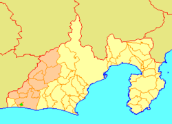 Location of Yūtō in Shizuoka Prefecture | |||
 Yūtō Location in Japan | |||
| Coordinates: 34°41′40″N 137°37′50″E / 34.69444°N 137.63056°ECoordinates: 34°41′40″N 137°37′50″E / 34.69444°N 137.63056°E | |||
| Country | Japan | ||
| Region | Chūbu (Tōkai) | ||
| Prefecture | Shizuoka Prefecture | ||
| District | Hamana | ||
| Merged |
July 1, 2005 (now part of Nishi-ku, Hamamatsu) | ||
| Area | |||
| • Total | 8.15 km2 (3.15 sq mi) | ||
| Population (June 1, 2005) | |||
| • Total | 13,825 | ||
| • Density | 1,696/km2 (4,390/sq mi) | ||
| Symbols | |||
| • Tree | Maki | ||
| • Flower | Rhododendron | ||
| Time zone | UTC+9 (JST) | ||


Yūtō (雄踏町 Yūtō-chō) was a town located in Hamana District, Shizuoka Prefecture, Japan.
On July 1, 2005, Yūtō, along with the cities of Tenryū and Hamakita, town of Haruno (from Shūchi District), the towns of Hosoe, Inasa and Mikkabi (all from Inasa District), the towns of Misakubo and Sakuma, the village of Tatsuyama (all from Iwata District), and the town of Maisaka (also from Hamana District), was merged into the expanded city of Hamamatsu.[1]
Yūtō was located on the eastern banks of Lake Hamana just north of Maisaka Station on the JR Tōkaidō line.
Prior to its merger with Hamamatsu, Yūtō enjoyed a sister city relationship with Airdrie, Alberta, Canada. This relationship was founded on July 4, 1995.
Attractions
- Yūtō-chō Culture Center - https://www.mb.epss.jp/contents/facilities/1410/index.html (Japanese)
- Hamanako Royal Hotel - http://www.inhamamatsu.com/hotel/hamanako-royal-hotel.php
- "Takiya Ryo" Fishing - https://japan-highlightstravel.com/en/travel/hamamatsu/090047/- A description of this kind of fishing which is done at nighttime with lamps, harpoons, and nets.
Famous people
- Shinichirô Sawai (澤井信一郎 ) - Movie Director
- Hironoshin Furuhashi (古橋廣之進 ) - Honorary President of the Japan Swimming Federation
- Yoko Kando (漢人陽子) - Barcelona Olympic Team Member
References
- ↑ Merger and Becoming an Ordinance-designated City Hamamatsu City, History of Hamamatsu.
External links
- Shinichirô Sawai's Page on IMDB
- Furuhashi Hironoshin, Honorary Citizen of Yuto Town - Hamamatsu City Information, Hamamatsu Regional Resource Information Management Project
- Young Friends Say Sayonara - Airdrie Echo, Article about the former sister-city relationship
This article is issued from
Wikipedia.
The text is licensed under Creative Commons - Attribution - Sharealike.
Additional terms may apply for the media files.