Nishi-ku, Hamamatsu
| Nishi 西区 | |
|---|---|
| Ward | |
| Nishi Ward | |
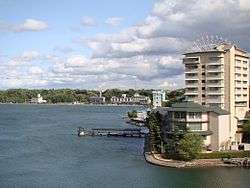
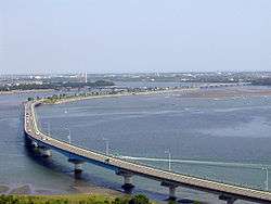 Lake Hamana and Hamanako Road Bridge | |
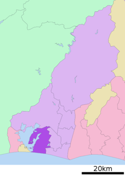 Location of Nishi-ku in Shizuoka | |
 Nishi | |
| Coordinates: 34°41′33.77″N 137°38′43.2″E / 34.6927139°N 137.645333°ECoordinates: 34°41′33.77″N 137°38′43.2″E / 34.6927139°N 137.645333°E | |
| Country | Japan |
| Region | Chūbu |
| Prefecture | Shizuoka |
| City | Hamamatsu |
| Area | |
| • Total | 114.71 km2 (44.29 sq mi) |
| Population (March 1, 2018) | |
| • Total | 110,007 |
| • Density | 959/km2 (2,480/sq mi) |
| Time zone | UTC+9 (Japan Standard Time) |
| Phone number | 053-597-1111 |
| Address | 1-31-1 Yūtō, Nishi-ku, Hamamatsu, Shizuoka 431-0193 |
| Website | Nishi-ku home page |
Nishi-ku (西区 Nishi-ku) is one of seven wards of Hamamatsu, Shizuoka, Japan, located in the southwest corner of the city. It is bordered by Naka-ku, Kita-ku, Minami-ku, and the city of Kosai. The 3rd largest ward of Hamamatsu in terms of area, much of the ward is still rural, with farms and rice fields.
Nishi-ku was created on April 1, 2007 when Hamamatsu became a city designated by government ordinance (a "designated city").
Nishi-ku is served by Maisaka Station and Bentenjima Station on the Tōkaidō Main Line railway.
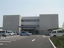
Nishi Ward Office, Hamamatsu
Education
International schools:
- Mundo de Alegria - Peruvian school (ペルー学校) and Brazilian primary school[1][2]
References
- ↑ "Ubicación y Acceso." Mundo de Alegría. Retrieved on October 24, 2015. "〒431-0102 Shizuoka-ken Hamamatsu-shi Nishi-ku Yuto-cho Ubumi 9611-1" - Japanese address: "住所 〒431-0102 静岡県 浜松市 西区 雄踏町 宇布見 9611-1"
- ↑ "Escolas Brasileiras Homologadas no Japão" (Archived February 7, 2008, at the Wayback Machine.). Embassy of Brazil in Tokyo. Retrieved on October 13, 2015. "3. Colégio Mundo de Alegria (Hamamatsu)[...]Endereço: 9611-1 Ubumi, Yuto-cho, Nishi-ku, Hamamatsu-shi, Shizuoka-ken 431-0102"
| Wikimedia Commons has media related to Nishi-ku, Hamamatsu. |
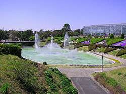
Hamamatsu Flower Park
Kanzanji Hot Springs's buildings
| Wards of Shizuoka | ||
|---|---|---|
| Wards of Hamamatsu | ||
| Special cities | ||
| Cities | ||
| Districts | ||
This article is issued from
Wikipedia.
The text is licensed under Creative Commons - Attribution - Sharealike.
Additional terms may apply for the media files.