Yélékébougou
| Yélékébougou | |
|---|---|
| Commune and village | |
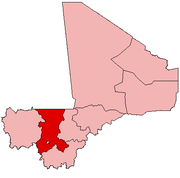
 Yélékébougou Location in Mali | |
| Coordinates: 12°58′25″N 8°2′25″W / 12.97361°N 8.04028°WCoordinates: 12°58′25″N 8°2′25″W / 12.97361°N 8.04028°W | |
| Country |
|
| Region | Koulikoro Region |
| Cercle | Kati Cercle |
| Area[1] | |
| • Total | 288 km2 (111 sq mi) |
| Population (2009 census)[2] | |
| • Total | 7,257 |
| • Density | 25/km2 (65/sq mi) |
| Time zone | UTC+0 (GMT) |
Yélékébougou is a village and rural commune in the Cercle of Kati in the Koulikoro Region of south-western Mali. The commune has an area of approximately 288 square kilometers and includes 16 villages.[3] In the 2009 census the commune had a population of 7,257.[2] The village of Yélékébougou is 30 km north of the town of Kati, the chef-lieu of the cercle.
References
- ↑ Common and Fundamental Operational Datasets Registry: Mali, United Nations Office for the Coordination of Humanitarian Affairs, archived from the original on January 6, 2012 . commune_mali.zip (Originally from the Direction Nationale des Collectivités Territoriales, République du Mali)
- 1 2 Resultats Recensement Général de la Population et de l’Habitat 2009 (Région de Koulikoro) (PDF) (in French), République de Mali: Institut National de la Statistique .
- ↑ Communes de la Région de Koulikoro (PDF) (in French), Ministère de l’administration territoriale et des collectivités locales, République du Mali .
External links
- Plan de Sécurité Alimentaire Commune Rurale de Yélékébougou 2008-2012 (PDF) (in French), Commissariat à la Sécurité Alimentaire, République du Mali, USAID-Mali, 2008 .
This article is issued from
Wikipedia.
The text is licensed under Creative Commons - Attribution - Sharealike.
Additional terms may apply for the media files.