Siaolin Village, Kaohsiung
Coordinates: 23°09′45″N 120°38′40″E / 23.162497°N 120.644388°E
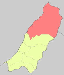

Siaolin Village (Chinese: 小林村; Hanyu Pinyin: Xiaolin; Tongyong Pinyin: Siaolin; Wade–Giles: Hsiao-Lin) is a village in the rural district of Jiasian, Kaohsiung City, Taiwan. It is in a largely agricultural area and was destroyed by a landslide during Typhoon Morakot in 2009.[1] Siaolin is also one of the biggest community of indigenous Taivoan people.
History
Due to the influx of Siraya people in early 18th century to Yujin Basin, Taivoan people started to migrate from Tainan to Kaohsiung between 1722 and 1744. Nearly 150 years later, some Taivoan people from Aliguan in Kaohsiung further migrated to a river terrace 10 km to the north of Aliguan for hunting. During the Japanese Occupation Period, in order to have Taivoan people counter the Mountain Indigenous people so as to control the camphor forest in Jiaxian and Namasia, Japanese government collectively moved more Taivoan people to the river terrace, which later became Siaolin Village in 1904, said to be named after the family name of the local Japanese police officer Kobayashi (Hiragana: こばやし; Chinese: 小林; Tongyong Pinyin: Siaolin).
Typhoon Morakot
Typhoon Morakot brought more than 60% of the average rainfall (about 2440–3270 mm) and 85% of the total rainfall in 2009.[2][3] This excessive rainfall from Typhoon Morakot resulted in a landslide to occur at 6:17 a.m. on 9 August 2009.[2]
Impacts and Casualties
There are two parts of Siaolin Village, north and south. The north part is located at a lower elevation and was completely wiped out by the landslide while the south part was unaffected. Main sediment had only buried part of the village, but an artificial dam broke, burying the rest of it.[2][3] The entire village was nearly razed to the ground, leaving one building standing.[1]
Over 600 residents were believed to have been buried alive, while 150 residents were transported to safety after the disaster.[1] Some people remained trapped several days after the disaster and was in urgent need for assistance.[4]
Tourism and agriculture, the village's main industry, were put to a complete halt in the village.[2] The Qishan River became dammed because of the debris (otherwise known as a landslide dam), effecting the ecosystem in the river and surrounding area.[2]
Aftermath
Rescuers and soldiers were dispatched by the government to look for survivors, but arrival was slow due to the amount of debris and continuous fall of rain.[4] Measurements were also taken and the average depth of the landslide was approximated to be 44.6 mm.[2]
Over 400 people died because of this mass movement of land, and, even though this high death toll and devastation was not directly a result of flooding or winds but by another disaster created by excessive saturation of the land, Typhoon Morakot became the deadliest typhoon to hit Taiwan since the establishment of Taiwan's typhoon warning system in 1992.[2]
On 15 January 2011, a ground-breaking ceremony was held for Siaolin No. 2 at a plot of land where 120 permanent houses will be built for survivors of the landslide.[5] On 15 January 2012, the Xiaolin Village Memorial Park was opened to commemorate the victims.
See also
References
- 1 2 3 "600 believed buried alive at Siaolin". 2009-08-14. Retrieved 2011-01-16.
- 1 2 3 4 5 6 7 "Catastrophic Deep-Seated Landslide at Xiaolin Village in Taiwan Induced by 2009.8.9 Typhoon Morakot". Environmental Science and Engineering.
- 1 2 Wu, Chun-Hung; Chen, Su-Chin; Feng, Zheng-Yi (2013-05-02). "Formation, failure, and consequences of the Xiaolin landslide dam, triggered by extreme rainfall from Typhoon Morakot, Taiwan". Landslides. 11 (3): 357–367. doi:10.1007/s10346-013-0394-4. ISSN 1612-510X.
- 1 2 "Hundreds missing after Xiaolin mudslides - Taipei Times". www.taipeitimes.com. Retrieved 2016-11-18.
- ↑ "Ma launches New Cishan Bridge". Taipei Times. 2011-01-16. Retrieved 2011-01-16.
Districts of Kaohsiung | ||
|---|---|---|
| Urban area | .svg.png) | |
| Fongshan region | ||
| Gangshan region | ||
| Cishan region | ||
| Mountain indigenous districts | ||
Note: Although Hanyu Pinyin is the national standard, the Kaohsiung Government names its districts based on Tongyong Pinyin. | ||