Wyoming, Minnesota
| Wyoming, Minnesota | |
|---|---|
| City | |
 Location of the city of Wyoming within Chisago County, Minnesota | |
| Coordinates: 45°20′6″N 92°59′37″W / 45.33500°N 92.99361°W | |
| Country | United States |
| State | Minnesota |
| County | Chisago |
| Area[1] | |
| • Total | 21.29 sq mi (55.14 km2) |
| • Land | 20.26 sq mi (52.47 km2) |
| • Water | 1.03 sq mi (2.67 km2) |
| Elevation | 906 ft (276 m) |
| Population (2010)[2] | |
| • Total | 7,791 |
| • Estimate (2016)[3] | 7,856 |
| • Density | 370/sq mi (140/km2) |
| Time zone | UTC-6 (Central (CST)) |
| • Summer (DST) | UTC-5 (CDT) |
| ZIP code | 55092 |
| Area code(s) | 651 |
| FIPS code | 27-72022[4] |
| GNIS feature ID | 0654403[5] |
| Website | www.wyomingmn.org |
Wyoming is a city in Chisago County, Minnesota, United States. The population was 7,791 at the 2010 census.[6]
Geography
According to the United States Census Bureau, the city has a total area of 21.29 square miles (55.14 km2), of which, 20.26 square miles (52.47 km2) is land and 1.03 square miles (2.67 km2) is water.[1] Wyoming is located along the South Branch of the Sunrise River in East Central Minnesota.
Interstate 35 serves as a main route for the community.
History
Wyoming was platted in 1869 when the St. Paul and Duluth Railroad was extended to that point.[7] The city took its name from Wyoming Township.[8]
Wyoming served as the drop off point for a criminal gang related Depression Era kidnapping. In June 1933, William Hamm of Hamm's Brewery was released by his captors, the Barker–Karpis gang, following a collection of a $100,000 ransom payment ($1.825 mil. in 2015 dollars).[9]
Demographics
| Historical population | |||
|---|---|---|---|
| Census | Pop. | %± | |
| 1910 | 207 | — | |
| 1920 | 253 | 22.2% | |
| 1930 | 214 | −15.4% | |
| 1940 | 253 | 18.2% | |
| 1950 | 325 | 28.5% | |
| 1960 | 435 | 33.8% | |
| 1970 | 695 | 59.8% | |
| 1980 | 1,559 | 124.3% | |
| 1990 | 2,142 | 37.4% | |
| 2000 | 3,048 | 42.3% | |
| 2010 | 7,791 | 155.6% | |
| Est. 2016 | 7,856 | [3] | 0.8% |
| U.S. Decennial Census | |||
2010 census
As of the census[2] of 2010, there were 7,791 people, 2,738 households, and 2,154 families residing in the city. The population density was 384.6 inhabitants per square mile (148.5/km2). There were 2,845 housing units at an average density of 140.4 per square mile (54.2/km2). The racial makeup of the city was 96.6% White, 0.4% African American, 0.4% Native American, 0.9% Asian, 0.4% from other races, and 1.4% from two or more races. Hispanic or Latino of any race were 1.7% of the population.
There were 2,738 households of which 41.7% had children under the age of 18 living with them, 65.9% were married couples living together, 8.2% had a female householder with no husband present, 4.6% had a male householder with no wife present, and 21.3% were non-families. 16.6% of all households were made up of individuals and 8% had someone living alone who was 65 years of age or older. The average household size was 2.84 and the average family size was 3.19.
The median age in the city was 38.4 years. 28.4% of residents were under the age of 18; 7.1% were between the ages of 18 and 24; 25.8% were from 25 to 44; 29.8% were from 45 to 64; and 8.9% were 65 years of age or older. The gender makeup of the city was 50.3% male and 49.7% female.
2000 census
As of the census[4] of 2000, there were 3,048 people, 1,023 households, and 848 families residing in the city. The population density was 1,069.8 people per square mile (412.9/km²). There were 1,055 housing units at an average density of 370.3 per square mile (142.9/km²). The racial makeup of the city was 97.64% White, 0.39% African American, 0.52% Native American, 0.43% Asian, 0.07% Pacific Islander, 0.26% from other races, and 0.69% from two or more races. Hispanic or Latino of any race were 0.72% of the population.
There were 1,023 households out of which 50.1% had children under the age of 18 living with them, 69.2% were married couples living together, 10.9% had a female householder with no husband present, and 17.1% were non-families. 13.3% of all households were made up of individuals and 5.5% had someone living alone who was 65 years of age or older. The average household size was 2.94 and the average family size was 3.23.
In the city, the population was spread out with 32.6% under the age of 18, 7.1% from 18 to 24, 33.6% from 25 to 44, 19.7% from 45 to 64, and 7.0% who were 65 years of age or older. The median age was 32 years. For every 100 females, there were 97.8 males. For every 100 females age 18 and over, there were 94.7 males.
The median income for a household in the city was $56,192, and the median income for a family was $62,118. Males had a median income of $40,959 versus $28,272 for females. The per capita income for the city was $20,290. About 2.7% of families and 5.5% of the population were below the poverty line, including 4.7% of those under age 18 and 11.2% of those age 65 or over.
See also
- U.S. Route 61
- U.S. Route 61 in Minnesota
- Old Minnesota State Highway 98 – also known back in the wagon days as Wyoming Trail, as it was a trail to the many stagecoach stops to the Twin Cities. In the present day, this route is now marked as Chisago County Road 22.
References
- 1 2 "US Gazetteer files 2010". United States Census Bureau. Archived from the original on January 24, 2012. Retrieved 2012-11-13.
- 1 2 "American FactFinder". United States Census Bureau. Retrieved 2012-11-13.
- 1 2 "Population and Housing Unit Estimates". Retrieved June 9, 2017.
- 1 2 "American FactFinder". United States Census Bureau. Archived from the original on September 11, 2013. Retrieved 2008-01-31.
- ↑ "US Board on Geographic Names". United States Geological Survey. 2007-10-25. Retrieved 2008-01-31.
- ↑ "2010 Census Redistricting Data (Public Law 94-171) Summary File". American FactFinder. U.S. Census Bureau, 2010 Census. Archived from the original on July 21, 2011. Retrieved 23 April 2011.
- ↑ "Minnesota Place Names - Township and Village Information". Minnesota Historical Society. Retrieved 21 April 2011.
- ↑ Upham, Warren (1920). Minnesota Geographic Names: Their Origin and Historic Significance. Minnesota Historical Society. p. 110.
- ↑ Cleveland News (April 18, 1936). "Bremer Kidnapping Part 455 of 459". Federal Bureau of Investigation. p. 82. Retrieved 3 January 2016.
External links
Municipalities and communities of Chisago County, Minnesota, United States | ||
|---|---|---|
| Cities | 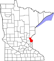 | |
| Townships | ||
| Unincorporated communities | ||
Coordinates: 45°20′11″N 92°59′50″W / 45.33639°N 92.99722°W