Palmdale, Minnesota
| Palmdale, Minnesota | |
|---|---|
| Unincorporated community | |
 Palmdale, Minnesota Location of the community of Palmdale within Shafer Township, Chisago County  Palmdale, Minnesota Palmdale, Minnesota (the US) | |
| Coordinates: 45°27′20″N 92°44′01″W / 45.45556°N 92.73361°WCoordinates: 45°27′20″N 92°44′01″W / 45.45556°N 92.73361°W | |
| Country | United States |
| State | Minnesota |
| County | Chisago County |
| Township | Shafer Township |
| Elevation | 935 ft (285 m) |
| Time zone | UTC-6 (Central (CST)) |
| • Summer (DST) | UTC-5 (CDT) |
| ZIP code | 55084 |
| Area code(s) | 651 |
| GNIS feature ID | 654868[1] |
Palmdale is an unincorporated community in Shafer Township, Chisago County, Minnesota, United States.
The community is located north of Taylors Falls at the junction of State Highway 95 (MN 95) and 350th Street. Dry Creek flows through the community. Nearby places include Taylors Falls, Shafer, Center City, Almelund, North Branch, and Wild Mountain Ski Recreation Area.
ZIP codes 55084 (Taylors Falls) and 55074 (Shafer) meet near Palmdale.
References
Municipalities and communities of Chisago County, Minnesota, United States | ||
|---|---|---|
| Cities | 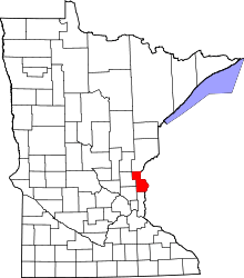 | |
| Townships | ||
| Unincorporated communities | ||
This article is issued from
Wikipedia.
The text is licensed under Creative Commons - Attribution - Sharealike.
Additional terms may apply for the media files.