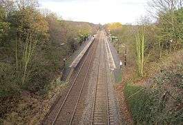
Wootton Wawen railway station
| Wootton Wawen | |
|---|---|
 | |
| Location | |
| Place | Wootton Wawen |
| Local authority | Stratford-on-Avon |
| Grid reference | SP147631 |
| Operations | |
| Station code | WWW |
| Managed by | West Midlands Trains |
| Number of platforms | 2 |
| DfT category | F2 |
|
Live arrivals/departures, station information and onward connections from National Rail Enquiries | |
| Annual rail passenger usage* | |
| 2012/13 |
|
| 2013/14 |
|
| 2014/15 |
|
| 2015/16 |
|
| 2016/17 |
|
| History | |
| Key dates | Opened 1908 |
| National Rail – UK railway stations | |
| * Annual estimated passenger usage based on sales of tickets in stated financial year(s) which end or originate at Wootton Wawen from Office of Rail and Road statistics. Methodology may vary year on year. | |
|
| |
Wootton Wawen railway station serves the village of Wootton Wawen in Warwickshire, England. It is served by trains between Birmingham and Stratford-upon-Avon.
The station was renamed from Wootton Wawen Platform to Wootton Wawen on 6 May 1974.[1] Under British Rail, the station was threatened with closure in 1985 (along with the line between Henley-in-Arden and Bearley Junction).[2] The plans were dropped in 1987 and the line remains open.
Services
The service in each direction between Birmingham Snow Hill and Stratford-Upon-Avon runs hourly (with most northbound trains running through to Stourbridge Junction). It is a request stop: passengers wishing to board a train here must signal to the driver; those wishing to alight must inform the train conductor.
There is no service on a Sunday.[3]
A normal weekday service operates on most Bank holidays.
References
- ↑ Slater, J.N., ed. (July 1974). "Notes and News: Stations renamed by LMR". Railway Magazine. London: IPC Transport Press Ltd. 120 (879): 363. ISSN 0033-8923.
- ↑ "The Railway - Wootton Wawen (1986)"BBC Domesday Reloaded
- ↑ Table 71 National Rail timetable, May 2016
External links
| Wikimedia Commons has media related to Wootton Wawen railway station. |
- Train times and station information for Wootton Wawen railway station from National Rail
- Historical photographs at www.warwickshirerailways.com
- Rail Around Birmingham and the West Midlands: Wootton Wawen station
| Preceding station | Following station | |||
|---|---|---|---|---|
| Henley-in-Arden | West Midlands Railway North Warwickshire Line |
Wilmcote | ||
Coordinates: 52°15′58″N 1°47′06″W / 52.266°N 1.785°W