Danzey railway station
| Danzey | |
|---|---|
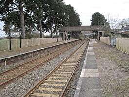 Danzey railway station in 2011 | |
| Location | |
| Place | Danzey Green |
| Local authority | Stratford-on-Avon |
| Grid reference | SP122696 |
| Operations | |
| Station code | DZY |
| Managed by | West Midlands Trains |
| Number of platforms | 2 |
| DfT category | F2 |
|
Live arrivals/departures, station information and onward connections from National Rail Enquiries | |
| Annual rail passenger usage* | |
| 2012/13 |
|
| 2013/14 |
|
| 2014/15 |
|
| 2015/16 |
|
| 2016/17 |
|
| History | |
| Key dates | Opened 1908[1] |
| National Rail – UK railway stations | |
| * Annual estimated passenger usage based on sales of tickets in stated financial year(s) which end or originate at Danzey from Office of Rail and Road statistics. Methodology may vary year on year. | |
|
| |
Danzey is a railway station which serves the small village of Danzey Green, and the larger but slightly more distant village of Tanworth-in-Arden in Warwickshire, England.
Situated on the North Warwickshire Line, the station was opened by the Great Western Railway in 1908 along with the line, and was originally known as Danzey for Tanworth. It is a few minutes walk from Danzey Green, and around one mile from Tanworth-in-Arden.
Services
The service in each direction between Birmingham and Stratford runs hourly (with most northbound trains continuing to Stourbridge Junction). Danzey is a request stop: passengers wishing to board a train here must signal to the driver; those wishing to alight must inform the train conductor.
There is no Sunday service.[3]
References
- ↑ Hendry, R. Preston; Hendry, R. Powell (1992). Paddington to the Mersey. Oxford Publishing Company. p. 106. ISBN 9780860934424. OCLC 877729237.
- ↑ Hendry, R. Preston; Hendry, R. Powell (1992). Paddington to the Mersey. Oxford Publishing Company. p. 106. ISBN 9780860934424. OCLC 877729237.
- ↑ Table 71 National Rail timetable, May 2016
External links
| Wikimedia Commons has media related to Danzey railway station. |
- Train times and station information for Danzey railway station from National Rail
- Historical photographs of Danzey station from www.warwickshirerailways.com
- Rail Around Birmingham and the West Midlands: Danzey station
| Preceding station | Following station | |||
|---|---|---|---|---|
| Wood End | West Midlands Railway North Warwickshire Line |
Henley-in-Arden | ||
Coordinates: 52°19′26″N 1°49′16″W / 52.324°N 1.821°W