Wollondilly Shire
| Wollondilly Shire New South Wales | |||||||||||||||
|---|---|---|---|---|---|---|---|---|---|---|---|---|---|---|---|
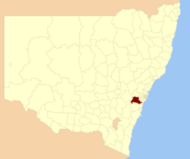 Location in New South Wales | |||||||||||||||
| Coordinates | 34°11′S 150°36′E / 34.183°S 150.600°ECoordinates: 34°11′S 150°36′E / 34.183°S 150.600°E | ||||||||||||||
| Population | 48,519 (2016 census)[1] | ||||||||||||||
| • Density | 18.95/km2 (49.09/sq mi) | ||||||||||||||
| Area | 2,560 km2 (988.4 sq mi) | ||||||||||||||
| Mayor | Judy Hannan (Independent) | ||||||||||||||
| Council seat | Picton[2] | ||||||||||||||
| Region | Macarthur, Blue Mountains, Central Tablelands | ||||||||||||||
| State electorate(s) | Wollondilly | ||||||||||||||
| Federal Division(s) | |||||||||||||||
|
| |||||||||||||||
| Website | Wollondilly Shire | ||||||||||||||
| |||||||||||||||
Wollondilly Shire is a periurban local government area adjacent to the south-western fringe of Sydney, parts of which fall into the Macarthur, Blue Mountains and Central Tablelands regions in the state of New South Wales, Australia.
Wollondilly Shire is named after the Wollondilly River. The area is traversed by the Hume Highway and the Southern Highlands railway line. Wollondilly Shire contains several small towns and villages broken up by farms and sandstone gorges. To its west is wilderness and includes the Nattai Wilderness and the Burragorang Valley. The majority of the Shire is either national park or forms part of the water catchment for Sydney's water supply. The Shire provides 97% of Sydney's water supply.
The Mayor of Wollondilly Shire Council is Cr. Judith Hannan, an independent politician.
Towns, villages and localities
Towns, villages and localities in the Wollondilly Shire are:
- Appin
- Bargo
- Bingara Gorge
- Belimbla Park
- Brownlow Hill
- Buxton
- Camden Park
- Cawdor
- Couridjah
- Douglas Park
- Glenmore
- Lakesland
- Maldon
- Menangle
- Mount Hunter
- Mowbray Park
- Oakdale
- Orangeville
- Pheasants Nest
- Picton
- Razorback
- Silverdale
- Tahmoor
- Theresa Park
- The Oaks
- Thirlmere
- Warragamba
- Werombi
- Wilton
- Yanderra
- Yerranderie
Demographics
At the 2016 census, there were 48,519 people in the Wollondilly local government area, with an equal proportion of males and females. Aboriginal and Torres Strait Islander people made up 2.4% of the population which is on par with the national average. The median age of people in the Wollondilly Shire was 36 years. Children aged 0–14 years made up 23.1% of the population and people aged 65 years and over made up 10.8% of the population. Of people in the area aged 15 years and over, 54.9% were married and 10.4% were either divorced or separated.[3]
Population growth in the Wollondilly Shire between the 2001 Census and the 2006 Census was 9.18%; and in the subsequent five years to the 2011 Census, population growth was 7.23%. This was higher than the population growth for Australia from 2001 to 2006 (5.78%) but less than the national figure for 2006 to 2011 (8.32%).[4] The median weekly income for residents within the Wollondilly Shire was marginally higher than the national average.[3][5]
At the 2011 Census, the proportion of residents in the Wollondilly local government area who stated their ancestry as Australian or Anglo-Saxon was more than 63% (national average was 65.2%). More than 69% of Wollondilly Shire residents nominated a religious affiliation of Christianity at the 2011 Census, which was well above the national average of 50.2%. Compared to the national average, there was a lower than average proportion of households in the Wollondilly local government area (8.3%) where two or more languages were spoken (national average was 20.4%), and a significantly higher proportion (91.2%) where English only was spoken at home (national average was 76.8%).[3]
| Selected historical census data for Wollondilly local government area | ||||||
|---|---|---|---|---|---|---|
| Census year | 2001[4] | 2006[5] | 2011[3] | 2016[1] | ||
| Population | Estimated residents on census night | 36,953 | 40,344 | 43,259 | 48,519 | |
| LGA rank in terms of size within New South Wales | 26th | 49th | ||||
| % of New South Wales population | 0.63% | |||||
| % of Australian population | 0.20% | |||||
| Cultural and language diversity | ||||||
| Ancestry, top responses | Australian | 33.9% | ||||
| English | 29.2% | |||||
| Irish | 7.9% | |||||
| Scottish | 6.2% | |||||
| Italian | 2.9% | |||||
| Language, top responses (other than English) | Italian | 0.8% | ||||
| Arabic | 0.5% | |||||
| Maltese | 0.5% | |||||
| Greek | n/c | |||||
| German | 0.4% | |||||
| Religious affiliation | ||||||
| Religious affiliation, top responses | Anglican | 33.4% | ||||
| Catholic | 29.3% | |||||
| No Religion | 11.2% | |||||
| Uniting Church | 5.3% | |||||
| Presbyterian and Reformed | 3.2% | |||||
| Median weekly incomes | ||||||
| Personal income | Median weekly personal income | A$502 | A$617 | |||
| % of Australian median income | 107.7% | 106.9% | ||||
| Family income | Median weekly family income | A$1,186 | A$1,661 | |||
| % of Australian median income | 115.5% | 112.2% | ||||
| Household income | Median weekly household income | A$1,321 | A$1,478 | |||
| % of Australian median income | 112.8% | 119.8% | ||||
Council
Current composition and election method
Wollondilly Shire Council is composed of nine Councillors elected proportionally as three separate wards, each electing three Councillors. All Councillors are elected for a fixed four-year term of office. The Mayor is elected by the Councillors at the first meeting of the Council. [6][7][8]
| Party | Councillors | |
|---|---|---|
| Independents | 9 | |
| Total | 9 | |
Most of the current Council were elected in 2016, with the exception of Matt Smith, who was elected at a by-election following the resignation of former Councillor Ray Law. The current members of the council are:
| Ward | Councillor | Party | Notes | |
|---|---|---|---|---|
| Central Ward[6] | Robert Khan | Independent | Deputy Mayor | |
| Michael Banasik | Independent | Member Liberal Party NSW | ||
| Blair Briggs | Independent | |||
| East Ward[7] | Matthew Deeth | Independent | ||
| Matt Smith | Independent | |||
| Noel Lowry | Independent | Member Australian Labor Party | ||
| North Ward[8] | Judith Hannan | Independent | Mayor | |
| Simon Landow | Independent | Member Liberal Party NSW | ||
| Matt Gould | Independent | |||
Heritage listings
The Wollondilly Shire has a number of heritage-listed sites, including:
- Appin, Cataract Road: Cataract Dam[9]
- Appin, Wilton Road: Windmill Hill, Appin[10]
- Bargo, Avon Dam Road: Nepean Dam[11]
- Bargo, Hume Highway: Wirrimbirra Sanctuary[12]
- Bargo, Main Southern railway 96.265 kms: Bargo railway viaduct[13]
- Camden Park, Elizabeth Macarthur Avenue: Camden Park Estate[14]
- Cordeaux, Cordeaux River: Cordeaux Dam[15]
- Couridjah, Main Southern railway: Couridjah railway station[16]
- Menangle, Main Southern railway: Menangle railway station[17]
- Menangle, Main Southern railway: Nepean River railway bridge, Menangle[18]
- Orangeville, Brownlow Hill Loop Road: Brownlow Hill Estate[19]
- Picton, Hume Highway Deviation: Jarvisfield[20]
- Picton, Main Southern railway: Picton railway station[21]
- Picton, Main Southern railway: Stonequarry Creek railway viaduct, Picton[22]
- Picton, Oaks Road: Abbotsford[23]
- Picton, Prince Street: Victoria Bridge, Picton[24]
- Tahmoor, Main Southern railway: Tahmoor railway station[25]
- Thirlmere, NSW Rail Transport Museum, Barbour Road: Rail Paybus FP1[26]
- Warragamba, Coxs River Arms: Coxs River track[27]
- Warragamba, Warragamba Dam: Megarritys Bridge[28]
- Warragamba, Warragamba Dam: Warragamba Dam - Haviland Park[29]
- Warragamba, Warragamba Dam: Warragamba Dam Emergency Scheme[30]
- Wilton, Wilton Park Road: Wilton Park[31]
Local media
Wollondilly is home to two local newspapers, the Macarthur Chronicle Wollondilly edition and the Wollondilly Advertiser. Other regional media which serve the area are radio stations, 2MCR and C91.3FM, the District Reporter newspaper, and the Wollondilly Trumpeter, a newsletter.
References
- 1 2 Australian Bureau of Statistics (27 June 2017). "Wollondilly (A)". 2016 Census QuickStats. Retrieved 6 July 2017.

- ↑ "Wollondilly Shire Council". Division of Local Government. Retrieved 27 November 2006.
- 1 2 3 4 Australian Bureau of Statistics (31 October 2012). "Wollondilly (A)". 2011 Census QuickStats. Retrieved 29 November 2012.
- 1 2 Australian Bureau of Statistics (9 March 2006). "Wollondilly (A)". 2001 Census QuickStats. Retrieved 27 November 2012.
- 1 2 Australian Bureau of Statistics (25 October 2007). "Wollondilly (A)". 2006 Census QuickStats. Retrieved 27 November 2012.
- 1 2 "Wollondilly Shire Council - Central Ward". Local Government Elections 2012. Electoral Commission of New South Wales. 16 September 2012. Retrieved 24 September 2012.
- 1 2 "Wollondilly Shire Council - East Ward". Local Government Elections 2012. Electoral Commission of New South Wales. 16 September 2012. Retrieved 24 September 2012.
- 1 2 "Wollondilly Shire Council - North Ward". Local Government Elections 2012. Electoral Commission of New South Wales. 16 September 2012. Retrieved 24 September 2012.
- ↑ "Cataract Dam, New South Wales State Heritage Register (NSW SHR) Number H01359". New South Wales State Heritage Register. Office of Environment and Heritage. Retrieved 18 May 2018.
- ↑ "Windmill Hill Group, including Ruins, New South Wales State Heritage Register (NSW SHR) Number H01931". New South Wales State Heritage Register. Office of Environment and Heritage. Retrieved 18 May 2018.
- ↑ "Nepean Dam, New South Wales State Heritage Register (NSW SHR) Number H01368". New South Wales State Heritage Register. Office of Environment and Heritage. Retrieved 18 May 2018.
- ↑ "Wirrimbirra Sanctuary, New South Wales State Heritage Register (NSW SHR) Number H01508". New South Wales State Heritage Register. Office of Environment and Heritage. Retrieved 18 May 2018.
- ↑ "Bargo Railway Viaduct, New South Wales State Heritage Register (NSW SHR) Number H01024". New South Wales State Heritage Register. Office of Environment and Heritage. Retrieved 18 May 2018.
- ↑ "Camden Park, New South Wales State Heritage Register (NSW SHR) Number H00341". New South Wales State Heritage Register. Office of Environment and Heritage. Retrieved 18 May 2018.
- ↑ "Cordeaux Dam, New South Wales State Heritage Register (NSW SHR) Number H01360". New South Wales State Heritage Register. Office of Environment and Heritage. Retrieved 18 May 2018.
- ↑ "Couridjah Railway Station, New South Wales State Heritage Register (NSW SHR) Number H01121". New South Wales State Heritage Register. Office of Environment and Heritage. Retrieved 18 May 2018.
- ↑ "Menangle Railway Station group, New South Wales State Heritage Register (NSW SHR) Number H01191". New South Wales State Heritage Register. Office of Environment and Heritage. Retrieved 18 May 2018.
- ↑ "Menangle rail bridge over Nepean River, New South Wales State Heritage Register (NSW SHR) Number H01047". New South Wales State Heritage Register. Office of Environment and Heritage. Retrieved 18 May 2018.
- ↑ "Brownlow Hill Estate, New South Wales State Heritage Register (NSW SHR) Number H01489". New South Wales State Heritage Register. Office of Environment and Heritage. Retrieved 18 May 2018.
- ↑ "Jarvisfield, New South Wales State Heritage Register (NSW SHR) Number H00305". New South Wales State Heritage Register. Office of Environment and Heritage. Retrieved 18 May 2018.
- ↑ "Picton Railway Station group, New South Wales State Heritage Register (NSW SHR) Number H01224". New South Wales State Heritage Register. Office of Environment and Heritage. Retrieved 18 May 2018.
- ↑ "Picton railway viaduct over Stonequarry Creek, New South Wales State Heritage Register (NSW SHR) Number H01051". New South Wales State Heritage Register. Office of Environment and Heritage. Retrieved 18 May 2018.
- ↑ "Abbotsford, New South Wales State Heritage Register (NSW SHR) Number H00073". New South Wales State Heritage Register. Office of Environment and Heritage. Retrieved 18 May 2018.
- ↑ "Victoria Bridge over Stonequarry Creek, New South Wales State Heritage Register (NSW SHR) Number H01484". New South Wales State Heritage Register. Office of Environment and Heritage. Retrieved 18 May 2018.
- ↑ "Tahmoor Railway Station Group, New South Wales State Heritage Register (NSW SHR) Number H01258". New South Wales State Heritage Register. Office of Environment and Heritage. Retrieved 18 May 2018.
- ↑ "Rail Paybus FP1, New South Wales State Heritage Register (NSW SHR) Number H01673". New South Wales State Heritage Register. Office of Environment and Heritage. Retrieved 18 May 2018.
- ↑ "Track, New South Wales State Heritage Register (NSW SHR) Number H01372". New South Wales State Heritage Register. Office of Environment and Heritage. Retrieved 18 May 2018.
- ↑ "Megarritys Bridge, New South Wales State Heritage Register (NSW SHR) Number H01367". New South Wales State Heritage Register. Office of Environment and Heritage. Retrieved 18 May 2018.
- ↑ "Warragamba Dam - Haviland Park, New South Wales State Heritage Register (NSW SHR) Number H01375". New South Wales State Heritage Register. Office of Environment and Heritage. Retrieved 18 May 2018.
- ↑ "Warragamba Emergency Scheme, New South Wales State Heritage Register (NSW SHR) Number H01376". New South Wales State Heritage Register. Office of Environment and Heritage. Retrieved 18 May 2018.
- ↑ "Wilton Park, New South Wales State Heritage Register (NSW SHR) Number H00257". New South Wales State Heritage Register. Office of Environment and Heritage. Retrieved 18 May 2018.
| Wikimedia Commons has media related to Wollondilly River. |