Wisconsin Highway 310
| ||||
|---|---|---|---|---|
| Route information | ||||
| Maintained by WisDOT | ||||
| Length | 8.72 mi[1] (14.03 km) | |||
| Major junctions | ||||
| West end |
| |||
| East end |
| |||
| Location | ||||
| Counties | Manitowoc | |||
| Highway system | ||||
| ||||

State Trunk Highway 310 (often called Highway 310 or simply 310) is a state highway in the U.S. state of Wisconsin. It runs east–west in east central Wisconsin from near Manitowoc to Two Rivers. The nearly nine-mile-long (14 km) road passes through mainly rural areas and intersects multiple County Highways along the way. The route came about in 1984 when US 10 was rerouted southbound with I-43 and County Highway D fell into state control.
Route description
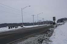
Highway 310 starts at exit 154 of Interstate 43 and US Highway 10.[2] Highway 310 is a 4 lane highway for the first 0.3 miles (0.5 km) of its route.[2][3] It then continues as a 2 lane, rural highway.[2] The road then intersects County Highway R, which leads north to Rockwood.[2] Highway 310 then goes eastbound and crosses over the Little Manitowoc River.[2][4] At 2.6 miles (4.18 km) Highway 310 intersects County Highway Q in a relatively remote area.[2][3] Continuing eastbound the route continues through an area of marshland, and passes a large cemetery.[2][4] County Highway B is the next major road that Highway 310 intersects.[2] After this intersection the route progresses through more rural farmland with patches of forest in between.[2][4] After passing County Highway DD the road continues into a residential area in Two Rivers.[2] Wisconsin Highway 310 becomes a southbound residential street while in Two Rivers known as Hawthorne Avenue, and then turns back eastbound where it meets its terminus at Wisconsin Highway 42.[2]
History
In 1984 US Highway 10 was rerouted to run smoothly with Interstate 43, the former US 10 was designated State Highway 310. The remaining 7 miles of the road were part of County Highway D until the county government transferred the road to state control, and hence it became part of Highway 310.[1] This route has not changed since.[1]
Major intersections
The entire route is in Manitowoc County.
| Location | mi[3] | km | Destinations | Notes | |
|---|---|---|---|---|---|
| Manitowoc | 0.0 | 0.0 | |||
| Two Rivers | 1.1 | 1.8 | Northbound County Road R/Southbound N Rapids Rd. | ||
| 2.6 | 4.2 | ||||
| 3.5 | 5.6 | ||||
| 8.72 | 14.03 | Terminus of Highway 310 | |||
| 1.000 mi = 1.609 km; 1.000 km = 0.621 mi | |||||
References
| Wikimedia Commons has media related to Wisconsin Highway 310. |
- 1 2 3 Bessert, Chris. "Wisconsin Highways: Highways 200-399 (Highway 310)". Wisconsin Highways. Retrieved 2007-03-20.
- 1 2 3 4 5 6 7 8 9 10 11 "Manitowoc CO" (PDF). Wisconsin Department of Transportation (WDOT). January 2009. Retrieved 2009-06-25.
- 1 2 3 "Overview of Highway 310 using Google Maps". Google. Retrieved 2009-06-25.
- 1 2 3 "Topographic map". U.S. Geological Survey. Microsoft Research Maps. Retrieved 2009-06-25.