Frytown, Iowa
| Frytown, Iowa | |
|---|---|
| Census-designated place | |
 | |
 Frytown | |
| Coordinates: 41°34′12″N 91°43′57″W / 41.57000°N 91.73250°WCoordinates: 41°34′12″N 91°43′57″W / 41.57000°N 91.73250°W | |
| Country | United States |
| State | Iowa |
| County | Johnson |
| Area[1] | |
| • Total | 0.810 sq mi (2.10 km2) |
| • Land | 0.810 sq mi (2.10 km2) |
| • Water | 0 sq mi (0 km2) |
| Elevation | 801 ft (244 m) |
| Population (2010)[1] | |
| • Total | 165 |
| • Density | 200/sq mi (79/km2) |
| Time zone | UTC-6 (Central (CST)) |
| • Summer (DST) | UTC-5 (CDT) |
| Area code(s) | 319 |
| GNIS feature ID | 463065[2] |
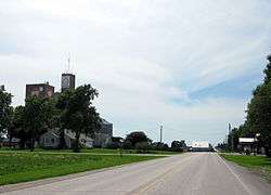
Frytown is an unincorporated community and census-designated place in Johnson County, Iowa, United States, about 10 miles southwest of Iowa City. The town has been known as Frytown since the 19th century, and is listed as such on state maps; the U.S. Geological Survey once called it Williamstown, though it has since changed the name.[3][2]
Frytown Conservation Area, a woodlands park belonging to Johnson County, is located about one mile northeast of Frytown.
The cemetery on the east end of town has markers for the original Fry family immigrants to the area including Samuel Preston Fry (and wife Fionna Melinda Grosscup) and his father, Titus R Fry (wife, Jane Preston). Yoder is the other prominent name in the Church of Christ graveyard.
As of the 2010 Census the population of Frytown was 165.[4]
References
- 1 2 "2010 Census Gazetteer Files - Places: Iowa". U.S. Census Bureau. Retrieved April 7, 2018.
- 1 2 "Frytown". Geographic Names Information System. United States Geological Survey.
- ↑ Folks in Frytown say maps mistaken, USA Today, 26 Oct 2007, https://www.usatoday.com/news/offbeat/2007-10-25-frytown_N.htm
- ↑ https://www.census.gov/2010census/popmap/ipmtext.php?fl=1929325
Municipalities and communities of Johnson County, Iowa, United States | ||
|---|---|---|
| Cities | ||
| Townships | ||
| CDP | ||
| Other unincorporated communities | ||
| Ghost town | ||
| Footnotes | ‡This populated place also has portions in an adjacent county or counties | |