Willard, Colorado
| Willard, Colorado | |
|---|---|
| Unincorporated community | |
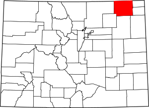
 Location in Logan County and the state of Colorado  Willard, Colorado (the US) | |
| Coordinates: 40°33′16″N 103°29′08″W / 40.55444°N 103.48556°WCoordinates: 40°33′16″N 103°29′08″W / 40.55444°N 103.48556°W | |
| Country |
|
| State |
|
| County | Logan County[1] |
| Elevation[1] | 4,337 ft (1,322 m) |
| Time zone | UTC-7 (MST) |
| • Summer (DST) | UTC-6 (MDT) |
| ZIP code[2] | 80741 (Merino) |
| Area code(s) | 970 |
| GNIS feature ID | 0182787 |
Willard is an unincorporated community located in Logan County, Colorado, United States. The U.S. Post Office at Merino (ZIP Code 80741) now serves Willard postal addresses.[2]
Willard was named for Willard House who owned land in the area.[3]
Geography
Willard is located at 40°33′16″N 103°29′08″W / 40.55444°N 103.48556°W (40.554374,-103.485546).
References
- 1 2 "US Board on Geographic Names". United States Geological Survey. 2007-10-25. Retrieved 2008-01-31.
- 1 2 "ZIP Code Lookup" (JavaScript/HTML). United States Postal Service. January 3, 2007. Retrieved January 3, 2007.
- ↑ Exploring Colorado Highways: Trip Trivia. Exploring America's Highway. 2007. p. 109. ISBN 978-0-9777301-0-0.
This article is issued from
Wikipedia.
The text is licensed under Creative Commons - Attribution - Sharealike.
Additional terms may apply for the media files.