Wilczek Land
| Native name: Земля Вильчека | |
|---|---|
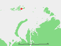 Location of Wilczek Land in Franz Josef Land | |
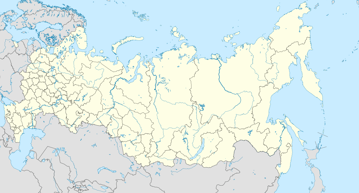 Wilczek Land Wilczek Land (Russia) | |
| Geography | |
| Location | Arctic Ocean |
| Coordinates | 80°35′N 60°30′E / 80.58°N 60.5°E |
| Archipelago | Franz Josef Land |
| Area | 2,203 km2 (851 sq mi) |
| Highest elevation | 606 m (1,988 ft) |
| Highest point | Wüllerstorf Mountains |
| Administration | |
| Oblast | Arkhangelsk Oblast |
Wilczek Land (Russian: Земля Вильчека; Zemlya Vil'cheka, German: Wilczek-Land), is a large island located at 80°35′N 60°30′E / 80.58°N 60.5°E. It is part of Franz Josef Land, Russia.
History
This large island is named after Austro-Hungarian Count Johann Nepomuk Wilczek.[1] Count Hans Wilczek was the most important sponsor of the Austro-Hungarian North Pole Expedition to Franz Josef Land.
Cape Geller (80°46′N 59°36′E / 80.767°N 59.600°E) was the wintering site for two members of the 1899 Welle Expedition waiting for their team's return from the pole.
This island should not be confused with the small Wilczek Island, "Остров Вильчека", located south-west of Salm Island, also in the Franz Josef group and named after the same person.
Geography
Wilczek Land is the second largest island of the Franz Josef Archipelago. It is almost completely glacierized except for two narrow areas along its western shores. The highest point on the island is 606 metres (1,988 feet).
Cape Ganza (Mys Ganza) is Wilczek Land's westernmost cape. The channel to the west, between Wilczek Land and Gallya, is known as Avstriyskyy Proliv (Австрийский пролив).[2]
Glaciers and ice domes
The Kupol Arktirazvedki (Купол Арктиразведки) ice dome covers the northeastern part of the island.[3] On the western side of the Arktirazvedki ice dome there are two glaciers, the Stremitelny Glacier (Lednik Stremitel’nyy) "Rushing Glacier", west of which flows the Molochny Glacier (Lednik Molochnyy) "Milky Glacier", both having their terminus in the northern shore.[4]
Further to the south the Kupol Tindalya (Купол Тиндаля) ice dome, named after Irish glaciologist John Tyndall, covers the eastern central area of the island.[5] To the southwest of it flows the Znamenity Glacier (Lednik Znamenityy), which has its terminus in the southern coast, east of the "Cloudy Dome" Kupol Oblachnyy (Купол Облачный) ice dome located at the southern end of the island.[6]
Adjacent minor islands
- Off Wilczek Land's southern bay, lies a small island called Klagenfurt Island (Остров Клагенфурт) about 9 kilometres (5.6 miles) away from the shore. This island is named after Klagenfurt (Slovene: Celovec), the capital of Carinthia.
- Right off Wilczek Land's eastern coast lie two small islets called Ostrova Gorbunova (Острова Горбунова) their location is (80°34′N 62°01′E / 80.567°N 62.017°E). These islets were named after Russian naturalist Gregory Petrovich Gorbunov.[7]
- 1.5 km off Wilczek land's southeastern cape lie four islets in a row named (from NE to SW):
- Ostrov Derevyannyy (Остров Деревянный).
- Ostrov Daues (Остров Дауэс) or Davis Island, was named after Antarctic navigator John King Davis.
- Ostrov Mak-Nulta (Остров Мак-Нульта).
- Ostrov Tillo (Остров Тилло), named after Ukrainian cartographer Oleksiy Tillo. This island should not be confused with Tillo Island in the Kara Sea.
See also
Bibliography
- Clements R. Markham, The Lands of Silence
References
- ↑ John Nepomuk Graf Wilchek
- ↑ "Zemlya Vil'cheka". Mapcarta. Retrieved 6 October 2016.
- ↑ "Kupol Arktirazvedki". Mapcarta. Retrieved 7 October 2016.
- ↑ "Lednik Stremitel'nyy". Mapcarta. Retrieved 7 October 2016.
- ↑ "Kupol Tindalya". Mapcarta. Retrieved 7 October 2016.
- ↑ "Kupol Oblachnyy". Mapcarta. Retrieved 7 October 2016.
- ↑ Gregory Petrovich Gorbunov