White Hall Township, Greene County, Illinois
| White Hall Township | |
|---|---|
| Township | |
 Location in Greene County | |
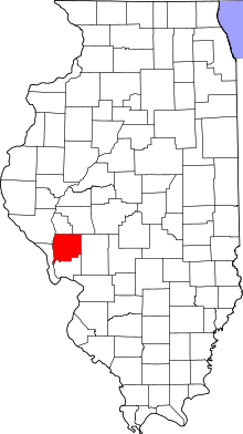 Greene County's location in Illinois | |
| Coordinates: 39°25′21″N 90°23′45″W / 39.42250°N 90.39583°WCoordinates: 39°25′21″N 90°23′45″W / 39.42250°N 90.39583°W | |
| Country | United States |
| State | Illinois |
| County | Greene |
| Established | November 4, 1884 |
| Area | |
| • Total | 42.13 sq mi (109.1 km2) |
| • Land | 42.04 sq mi (108.9 km2) |
| • Water | 0.09 sq mi (0.2 km2) 0.21% |
| Elevation | 538 ft (164 m) |
| Population (2010) | |
| • Estimate (2016)[1] | 2,850 |
| • Density | 72.3/sq mi (27.9/km2) |
| Time zone | UTC-6 (CST) |
| • Summer (DST) | UTC-5 (CDT) |
| ZIP codes | 62016, 62044, 62082, 62092 |
| FIPS code | 17-061-81269 |
White Hall Township is one of thirteen townships in Greene County, Illinois, USA. As of the 2010 census, its population was 3,040 and it contained 1,308 housing units.[2]
Geography
According to the 2010 census, the township has a total area of 42.13 square miles (109.1 km2), of which 42.04 square miles (108.9 km2) (or 99.79%) is land and 0.09 square miles (0.23 km2) (or 0.21%) is water.[2]
Cities, towns, villages
Unincorporated towns
(This list is based on USGS data and may include former settlements.)
Cemeteries
The township contains these nine cemeteries: Belltown, Henderson, Hicks, Highstreet, Jones, North, Sanders, Veterans of Foreign Wars Memorial and White Hall.
Major highways
Landmarks
- Conrad Park Street
- Lions Park
Demographics
| Historical population | |||
|---|---|---|---|
| Census | Pop. | %± | |
| Est. 2016 | 2,850 | [1] | |
| U.S. Decennial Census[3] | |||
School districts
- Greenfield Community Unit School District 10
- North Greene Unit School District 3
Political districts
- Illinois' 17th congressional district
- State House District 97
- State Senate District 49
Notes
- 1 2 "Population and Housing Unit Estimates". Retrieved June 9, 2017.
- 1 2 "Population, Housing Units, Area, and Density: 2010 - County -- County Subdivision and Place -- 2010 Census Summary File 1". United States Census. Retrieved 2013-05-28.
- ↑ "Census of Population and Housing". Census.gov. Retrieved June 4, 2016.
References
External links
Places adjacent to White Hall Township, Greene County, Illinois | |
|---|---|
Municipalities and communities of Greene County, Illinois, United States | ||
|---|---|---|
| Cities | ||
| Villages | ||
| Townships | ||
| Unincorporated communities | ||
This article is issued from
Wikipedia.
The text is licensed under Creative Commons - Attribution - Sharealike.
Additional terms may apply for the media files.