Whispering Pines, Gila County, Arizona
| Whispering Pines, Arizona | |
|---|---|
| Census-designated place | |
 Whispering Pines  Whispering Pines | |
| Coordinates: 34°22′16″N 111°17′0″W / 34.37111°N 111.28333°WCoordinates: 34°22′16″N 111°17′0″W / 34.37111°N 111.28333°W | |
| Country | United States |
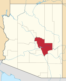
| State | Arizona |
| County | Gila |
| Area[1] | |
| • Total | 0.43 sq mi (1.11 km2) |
| • Land | 0.43 sq mi (1.11 km2) |
| • Water | 0.00 sq mi (0.00 km2) |
| Elevation | 5,200 ft (1,600 m) |
| Population (2010) | |
| • Total | 2,882 |
| • Estimate (2016)[2] | N/A |
| Time zone | UTC-7 (MST (no DST)) |
| Area code(s) | 928 |
| FIPS code | 04-82270 |
| GNIS feature ID | 2582900 |
Whispering Pines is a census-designated place (CDP) in Gila County, Arizona, United States. It is one of two locations in Arizona with this name, the other being a populated place in Greenlee County. The population was 148 at the 2010 United States Census.[3]
Geography
Whispering Pines is located in northern Gila County in the upper valley of the East Verde River, between Washington Park to the north and Beaver Valley to the south. It is 12 miles (19 km) north of Payson.
According to the United States Census Bureau, the Whispering Pines CDP has a total area of 0.43 square miles (1.11 km2), all of it land.[3]
Demographics
| Historical population | |||
|---|---|---|---|
| Census | Pop. | %± | |
| U.S. Decennial Census[4] | |||
References
- ↑ "2016 U.S. Gazetteer Files". United States Census Bureau. Retrieved Jul 18, 2017.
- ↑ "Population and Housing Unit Estimates". Retrieved June 9, 2017.
- 1 2 "Geographic Identifiers: 2010 Demographic Profile Data (G001): Whispering Pines CDP, Arizona". U.S. Census Bureau, American Factfinder. Retrieved November 8, 2016.
- ↑ "Census of Population and Housing". Census.gov. Retrieved June 4, 2016.
This article is issued from
Wikipedia.
The text is licensed under Creative Commons - Attribution - Sharealike.
Additional terms may apply for the media files.