Carrizo, Arizona
| Carrizo, Arizona | |
|---|---|
| Census-designated place | |
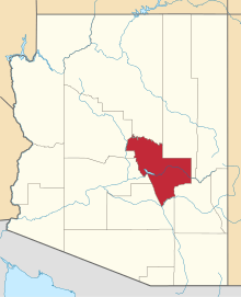
 Location of Carrizo in Gila County, Arizona. | |
 Carrizo Location of Carrizo in Gila County, Arizona.  Carrizo Carrizo (the US) | |
| Coordinates: 33°59′38″N 110°17′19″W / 33.99389°N 110.28861°WCoordinates: 33°59′38″N 110°17′19″W / 33.99389°N 110.28861°W | |
| Country | United States |
| State | Arizona |
| County | Gila |
| Area[1] | |
| • Total | 9.05 sq mi (23.44 km2) |
| • Land | 9.03 sq mi (23.39 km2) |
| • Water | 0.02 sq mi (0.06 km2) |
| Elevation | 4,918 ft (1,499 m) |
| Population (2010)[2] | |
| • Total | 3,363 |
| • Estimate (2016)[3] | N/A |
| Time zone | UTC-7 (Mountain (MST)) |
| Area code(s) | 928 |
| GNIS feature ID | 2481[4] |
Carrizo, Arizona, is a census-designated place in Gila County, Arizona, United States. As of the 2010 Census, its population was 127, of which 125 were Native American.[2] The community's name is Spanish for "reeds" and is likely derived from the Carriso band of Apache.[4]
It was the location of, or the nearest community to, the Black River Bridge, which is listed on the National Register of Historic Places.[5][6]
Demographics
| Historical population | |||
|---|---|---|---|
| Census | Pop. | %± | |
| U.S. Decennial Census[7] | |||
References
- ↑ "2016 U.S. Gazetteer Files". United States Census Bureau. Retrieved Jul 18, 2017.
- 1 2 "American FactFinder". United States Census Bureau. Archived from the original on 2013-09-11. Retrieved 2011-05-14.
- ↑ "Population and Housing Unit Estimates". Retrieved June 9, 2017.
- 1 2 "Carrizo". Geographic Names Information System. United States Geological Survey.
- ↑ National Park Service (2010-07-09). "National Register Information System". National Register of Historic Places. National Park Service.
- ↑ Vehicular Bridges in Arizona MPS
- ↑ "Census of Population and Housing". Census.gov. Retrieved June 4, 2016.
This article is issued from
Wikipedia.
The text is licensed under Creative Commons - Attribution - Sharealike.
Additional terms may apply for the media files.