West St Leonards railway station
| West St Leonards | |
|---|---|
 | |
| Location | |
| Place | Bulverhythe |
| Local authority | Hastings, East Sussex |
| Grid reference | TQ788090 |
| Operations | |
| Station code | WLD |
| Managed by | Southeastern |
| Number of platforms | 2 |
| DfT category | E |
|
Live arrivals/departures, station information and onward connections from National Rail Enquiries | |
| Annual rail passenger usage* | |
| 2012/13 |
|
| 2013/14 |
|
| 2014/15 |
|
| 2015/16 |
|
| 2016/17 |
|
| History | |
| 1887[1] | Station opens |
| National Rail – UK railway stations | |
| * Annual estimated passenger usage based on sales of tickets in stated financial year(s) which end or originate at West St Leonards from Office of Rail and Road statistics. Methodology may vary year on year. | |
|
| |
Railway stations in Hastings | |||||||||||||||||||||||||||||||||||||||||||||||||||||||||||||||||||||||||||||||||||||||||||||||||||||||||||||||||||||||||||||||||||||||||||
|---|---|---|---|---|---|---|---|---|---|---|---|---|---|---|---|---|---|---|---|---|---|---|---|---|---|---|---|---|---|---|---|---|---|---|---|---|---|---|---|---|---|---|---|---|---|---|---|---|---|---|---|---|---|---|---|---|---|---|---|---|---|---|---|---|---|---|---|---|---|---|---|---|---|---|---|---|---|---|---|---|---|---|---|---|---|---|---|---|---|---|---|---|---|---|---|---|---|---|---|---|---|---|---|---|---|---|---|---|---|---|---|---|---|---|---|---|---|---|---|---|---|---|---|---|---|---|---|---|---|---|---|---|---|---|---|---|---|---|---|
| |||||||||||||||||||||||||||||||||||||||||||||||||||||||||||||||||||||||||||||||||||||||||||||||||||||||||||||||||||||||||||||||||||||||||||
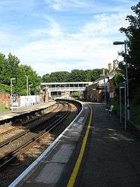
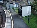
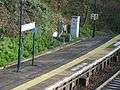
West St Leonards railway station is on the Hastings line in the south of England and is one of four stations that serve Hastings, East Sussex. It is 60 miles 59 chains (97.7 km) down the line from London Charing Cross and is situated between Crowhurst and St Leonards Warrior Square. The station and all trains serving it are operated by Southeastern.
Services
As of May 2010 the typical off-peak service is one train per hour to London Charing Cross via Tunbridge Wells, and one train per hour to Hastings.[2]
| Preceding station | Following station | |||
|---|---|---|---|---|
| Crowhurst | Southeastern Hastings Line |
St Leonards Warrior Square | ||
History
It is just north of St Leonards West Marina railway station, a now disused station that was the earliest station serving the area.
Rail layout
The Hastings Line (operated by Southeastern) joins the East Coastway Line (operated by Southern) immediately east of West St Leonards, at Bo-Peep junction, just before entering Bo-Peep tunnel. Plans were made for platforms to be built on the East Coastway Line for interchange but Hastings Borough Council decided that there was no economic or passenger benefit as interchange was already available at the next station (Warrior Square).
Gallery
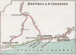 A 1914 Railway Clearing House map of lines around West St Leonards railway station.
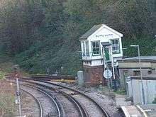
References
- ↑ "station opens". Archived from the original on 2011-07-11. Retrieved 2009-07-30.
- ↑ Network Rail Timetable May 2010: Table 206
External links
- Train times and station information for West St Leonards railway station from National Rail
Coordinates: 50°51′11″N 0°32′24″E / 50.853°N 0.540°E