West Hammond, New Mexico
| West Hammond, New Mexico | |
|---|---|
| Census-designated place | |
 West Hammond, New Mexico | |
| Coordinates: 36°41′08″N 108°2′29″W / 36.68556°N 108.04139°WCoordinates: 36°41′08″N 108°2′29″W / 36.68556°N 108.04139°W | |
| Country | United States |
| State | New Mexico |
| County | San Juan |
| Area[1] | |
| • Total | 7.54 sq mi (19.53 km2) |
| • Land | 7.46 sq mi (19.33 km2) |
| • Water | 0.08 sq mi (0.2 km2) |
| Elevation | 4,842 ft (1,476 m) |
| Population (2010)[2] | |
| • Total | 2,790 |
| • Density | 370/sq mi (140/km2) |
| Time zone | UTC-7 (Mountain (MST)) |
| • Summer (DST) | UTC-6 (MDT) |
| GNIS feature ID | 2584236[3] |
West Hammond is a census-designated place in San Juan County, New Mexico, United States. Its population was 2,790 as of the 2010 census.[2]
Geography
West Hammond is located at coordinates 36 ° 41'8 "N 108 ° 2'29" W. According to the United States Census Bureau, West Hammond has a total area of 19.53 square kilometers, of which 19.33 km² is land and (1.02%) 0.2 km² is water.[1]
Demographics
According to the 2010 census,[2] 2790 people were living in West Hammond. The population density was 142.87 inhabitants per square kilometer. Of the 2790 inhabitants, West Hammond was composed by 72.83% White, 0.79% were African American, 14.3% were Native American, 0.07% were Asian, 0% were Pacific Islanders, the 8.71% were of other races and 3.3% from two or more races. Of the total population 26.16% were Hispanic or Latino of any race.[4]
References
- 1 2 "2010 Census Gazetteer Files". United States Census Bureau. Retrieved September 19, 2016.
- 1 2 3 "American FactFinder". United States Census Bureau. Retrieved September 19, 2016.
- ↑ "West Hammond". Geographic Names Information System. United States Geological Survey.
- ↑ U.S. Board on Geographic Names
Municipalities and communities of San Juan County, New Mexico, United States | ||
|---|---|---|
| Cities | 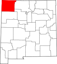 | |
| CDPs |
| |
| Unincorporated communities | ||
| Indian reservations | ||
| Footnotes | ‡This populated place also has portions in an adjacent county or counties | |