Westdowns
| Westdowns | |
|---|---|
 Westdowns Westdowns shown within Cornwall | |
| OS grid reference | SX059828 |
| Civil parish | |
| Unitary authority | |
| Ceremonial county | |
| Region | |
| Country | England |
| Sovereign state | United Kingdom |
| Post town | DELABOLE |
| Postcode district | PL33 |
| Dialling code | 01840 |
| Police | Devon and Cornwall |
| Fire | Cornwall |
| Ambulance | South Western |
| EU Parliament | South West England |
| UK Parliament | |
Westdowns (sometimes spelt incorrectly as Westdown) is a small hamlet in north Cornwall, England, United Kingdom. It lies half-a-mile south-west of Delabole and is sometimes considered part of that village, however, Westdowns is a distinct settlement. It is on the B3314 road.[1]
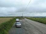
A lay-by near Westdowns
References
- ↑ Ordnance Survey One-inch Map of Great Britain; Bodmin and Launceston, sheet 186. 1961
External links
![]()
Cornwall Portal | |
| Unitary authorities | |
| Major settlements |
|
| Rivers | |
| Topics | |
This article is issued from
Wikipedia.
The text is licensed under Creative Commons - Attribution - Sharealike.
Additional terms may apply for the media files.