West Camel
| West Camel | |
|---|---|
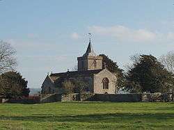 Church of All Saints, West Camel | |
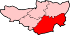
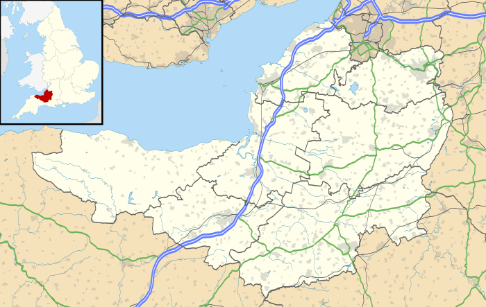 West Camel West Camel shown within Somerset | |
| Population | 459 (2011)[1] |
| OS grid reference | ST578249 |
| District | |
| Shire county | |
| Region | |
| Country | England |
| Sovereign state | United Kingdom |
| Post town | YEOVIL |
| Postcode district | BA22 7 |
| Dialling code | 01935 |
| Police | Avon and Somerset |
| Fire | Devon and Somerset |
| Ambulance | South Western |
| EU Parliament | South West England |
| UK Parliament | |
West Camel is a village and civil parish in south Somerset, England, about 7 miles (11.3 km) north of the town of Yeovil. Situated either side of the River Cam it lies just south of the A303 and has a population of 459.[1] The parish includes the hamlet of Urgashay.
Neighbouring villages include Queen Camel, and Bridgehampton.
History
The name "Camel" derives not from the animal, but from the name "Cantmeel", "Cantmell" or "Cantmel", by which West Camel was formerly known.[2] "Cantmeel" itself derives from the words cant (ridge) and mael (bare).[3] It has also been known as Camel Abbatis because of its association with Muchelney Abbey.[4]
It is one of many sites in England identified as a possible setting of The Strife of Camlann, the final battle of King Arthur.[3]
The earliest evidence of a settlement on the site dates from before AD 940, in the form of the remains of a Saxon preaching cross.[5] The parish of West Camel was part of the hundred of Somerton.[6]
The earliest written reference, dating from AD 995, takes the form of a grant by Aethelred II of the village to the monks of Muchelney Abbey.[5] Produce exacted for the grange of the abbey was held in an extant 15th-century tithe barn.[7]
There are earthworks 100 and 250 metres north of Downhead Manor Farm, showing the site of houses, possibly including a manor house, tracks and a fish pond. Having existed since before the Norman conquest, this settlement had been abandoned by the late 18th century.[8]
Running through West Camel is the Leland Trail, a 28 miles (45.1 km) footpath which follows in the footsteps of John Leland, as he traversed across South Somerset between 1535 and 1543, in the course of his investigation of the region's antiquities. The Leland Trail begins at King Alfred's Tower on the Wiltshire/Somerset border and finishes at Ham Hill Country Park.
Governance
The parish council has responsibility for local issues, including setting an annual precept (local rate) to cover the council’s operating costs and producing annual accounts for public scrutiny. The parish council evaluates local planning applications and works with the local police, district council officers, and neighbourhood watch groups on matters of crime, security, and traffic. The parish council's role also includes initiating projects for the maintenance and repair of parish facilities, as well as consulting with the district council on the maintenance, repair, and improvement of highways, drainage, footpaths, public transport, and street cleaning. Conservation matters (including trees and listed buildings) and environmental issues are also the responsibility of the council.
The village falls within the Non-metropolitan district of South Somerset, which was formed on 1 April 1974 under the Local Government Act 1972, having previously been part of Yeovil Rural District.[9] The district council is responsible for local planning and building control, local roads, council housing, environmental health, markets and fairs, refuse collection and recycling, cemeteries and crematoria, leisure services, parks, and tourism. West Camel is part of the electoral ward of Camelot.[10]
Somerset County Council is responsible for running the largest and most expensive local services such as education, social services, libraries, main roads, public transport, policing and fire services, trading standards, waste disposal and strategic planning.
It is also part of the Somerton and Frome county constituency represented in the House of Commons of the Parliament of the United Kingdom. It elects one Member of Parliament (MP) by the first past the post system of election, and part of the South West England constituency of the European Parliament which elects seven MEPs using the d'Hondt method of party-list proportional representation.
Religious sites
The Church of All Saints dates from the late 14th century and has been designated as a Grade I listed building.[11]
The rectory dates from the early 15th century. The older wing may form part of the Grange pertaining to Muchelney Abbey; the South wing was probably added by Revd. Henry Law between 1824 and 1836.[12]
Notable residents
- Richard Amerike (c. 1445–1503) was a wealthy English born merchant, Royal customs officer and Sheriff of Welsh descent. He was the principal owner of John Cabot's ship Matthew during his voyage of exploration to North America in 1497[13]
- Elizabeth Benger (1775-1827), the poet, novelist and biographer of Anne Boleyn, was baptised here on 15 June 1775.[14]
References
- 1 2 "Statistics for Wards, LSOAs and Parishes — SUMMARY Profiles" (Excel). Somerset Intelligence. Retrieved 4 January 2014.
- ↑ Bush, Robin (1994). Somerset: The Complete Guide. Dovecote Press. p. 172. ISBN 1-874336-26-1.
- 1 2 "A guide to West Camel". Information Britain. Retrieved 2009-03-15.
- ↑ Bush, Robin (1994). Somerset: The Complete Guide. Dovecote Press. p. 226. ISBN 1-874336-26-1.
- 1 2 "West Camel". Victoria County Histories. British History Online. Retrieved 2009-03-15.
- ↑ "Somerset Hundreds". GENUKI. Retrieved 19 October 2011.
- ↑ Historic England. "Tithe Barn, 8 metres West of The Rectory (262756)". Images of England. Retrieved 2009-02-09.
- ↑ Historic England. "Medieval settlement remains 100 m and 250 m north of Downhead Manor Farm (1021260)". National Heritage List for England. Retrieved 21 November 2014.
- ↑ "Yeovil RD". A vision of Britain Through Time. University of Portsmouth. Retrieved 4 January 2014.
- ↑ Ordnance Survey Election maps
- ↑ Historic England. "Church of All Saints (262745)". Images of England. Retrieved 2008-10-16.
- ↑ Historic England. "The Rectory (262755)". Images of England. Retrieved 2009-02-09.
- ↑ Peter MacDonald. "BBC History the naming of America". BBC. Retrieved 2008-08-25.
- ↑ ODNB entry: Retrieved 10 March 2011. Subscription required.
External links
| Wikimedia Commons has media related to West Camel. |
- Google map
- http://www.westcamel.org.uk/
- Somerset County Council
- www.nationalarchives.gov.uk/ - archive reference Anglo-Saxon charter: Aethelred II to Muchelney Abbey: