West Augusta, Virginia
| West Augusta, Virginia | |
|---|---|
| Unincorporated community | |
_in_West_Augusta%2C_Augusta_County%2C_Virginia.jpg) View east along US 250 entering West Augusta | |
 West Augusta, Virginia  West Augusta, Virginia | |
| Coordinates: 38°16′12″N 79°18′28″W / 38.27000°N 79.30778°WCoordinates: 38°16′12″N 79°18′28″W / 38.27000°N 79.30778°W | |
| Country | United States |
| State | Virginia |
| County | Augusta |
| Elevation | 1,890 ft (580 m) |
| Time zone | UTC−5 (Eastern (EST)) |
| • Summer (DST) | UTC−4 (EDT) |
| ZIP code | 24485 |
| Area code(s) | 540 |
| GNIS feature ID | 1500293[1] |
West Augusta is an unincorporated community in Augusta County, Virginia, United States. West Augusta is located at the intersection of U.S. Route 250 and Virginia State Route 629.[2] The source of the Calfpasture River, which flows through West Augusta, is located near the community to the north.[3]
Climate
The climate in this area is characterized by hot, humid summers and generally mild to cool winters. According to the Köppen Climate Classification system, West Augusta has a humid subtropical climate, abbreviated "Cfa" on climate maps.[4]
References
- ↑ "West Augusta". Geographic Names Information System. United States Geological Survey.
- ↑ Google (15 December 2012). "West Augusta, Virginia" (Map). Google Maps. Google. Retrieved 15 December 2012.
- ↑ "Calfpasture River". Geographic Names Information System. United States Geological Survey.
- ↑ Climate Summary for West Augusta, Virginia
Municipalities and communities of Augusta County, Virginia, United States | ||
|---|---|---|
| Towns | 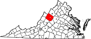 | |
| CDPs | ||
| Unincorporated communities | ||
| Footnotes | ‡This populated place also has portions in an adjacent county or counties | |
This article is issued from
Wikipedia.
The text is licensed under Creative Commons - Attribution - Sharealike.
Additional terms may apply for the media files.