Mossy Creek, Virginia
| Mossy Creek, Virginia | |
|---|---|
| Unincorporated community | |
 Mossy Creek, Virginia  Mossy Creek, Virginia | |
| Coordinates: 38°21′26″N 79°01′43″W / 38.35722°N 79.02861°WCoordinates: 38°21′26″N 79°01′43″W / 38.35722°N 79.02861°W | |
| Country | United States |
| State | Virginia |
| County | Augusta |
| Elevation | 1,260 ft (380 m) |
| Time zone | UTC-5 (Eastern (EST)) |
| • Summer (DST) | UTC-4 (EDT) |
| Area code(s) | 540 |
| GNIS feature ID | 1470787[1] |
Mossy Creek is an unincorporated community in Augusta County, Virginia, United States. Mossy Creek is located on Virginia State Route 42 3.3 miles (5.3 km) west-southwest of Bridgewater. The Hannah Miller House and the Henry Miller House, which are listed on the National Register of Historic Places, are both located near Mossy Creek.[2]
References
- ↑ "Mossy Creek". Geographic Names Information System. United States Geological Survey.
- ↑ National Park Service (2010-07-09). "National Register Information System". National Register of Historic Places. National Park Service.
Municipalities and communities of Augusta County, Virginia, United States | ||
|---|---|---|
| Towns | 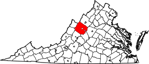 | |
| CDPs | ||
| Unincorporated communities | ||
| Footnotes | ‡This populated place also has portions in an adjacent county or counties | |
This article is issued from
Wikipedia.
The text is licensed under Creative Commons - Attribution - Sharealike.
Additional terms may apply for the media files.