Wentorf bei Hamburg
| Wentorf bei Hamburg | ||
|---|---|---|
| ||
 Wentorf bei Hamburg Location of Wentorf bei Hamburg within Herzogtum Lauenburg district 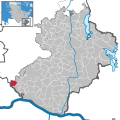  | ||
| Coordinates: 53°29′35″N 10°15′12″E / 53.49306°N 10.25333°ECoordinates: 53°29′35″N 10°15′12″E / 53.49306°N 10.25333°E | ||
| Country | Germany | |
| State | Schleswig-Holstein | |
| District | Herzogtum Lauenburg | |
| Government | ||
| • Mayor | Dirk Petersen (Die Grünen) | |
| Area | ||
| • Total | 6.87 km2 (2.65 sq mi) | |
| Elevation | 48 m (157 ft) | |
| Population (2016-12-31)[1] | ||
| • Total | 12,663 | |
| • Density | 1,800/km2 (4,800/sq mi) | |
| Time zone | CET/CEST (UTC+1/+2) | |
| Postal codes | 21465 | |
| Dialling codes | 040 | |
| Vehicle registration | RZ | |
| Website | www.wentorf.de | |
-Wappen.png)
Wentorf bei Hamburg is a municipality in the district of Lauenburg, in Schleswig-Holstein, Germany. It is situated on the river Bille, approx. 10 km northwest of the town of Geesthacht, and adjoining the town of Reinbek. It is situated on the city limits to the city of Hamburg and 20 km east of the centre of the city. As "Wendendorp" it was first named in 1246.
In the late 1940s it was the site of a large Displaced Persons camp for Eastern European refugees.[2] In the 1990s it was a home to asylum seekers from the Middle East who were housed in the disused barracks.
References
This article is issued from
Wikipedia.
The text is licensed under Creative Commons - Attribution - Sharealike.
Additional terms may apply for the media files.