Steinhorst, Schleswig-Holstein
| Steinhorst | ||
|---|---|---|
| ||
 Steinhorst Location of Steinhorst within Lauenburg district 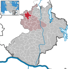  | ||
| Coordinates: 53°43′15″N 10°29′11″E / 53.72083°N 10.48639°ECoordinates: 53°43′15″N 10°29′11″E / 53.72083°N 10.48639°E | ||
| Country | Germany | |
| State | Schleswig-Holstein | |
| District | Lauenburg | |
| Municipal assoc. | Sandesneben-Nusse | |
| Government | ||
| • Mayor | Heinz-Peter Strunck | |
| Area | ||
| • Total | 16.37 km2 (6.32 sq mi) | |
| Elevation | 63 m (207 ft) | |
| Population (2016-12-31)[1] | ||
| • Total | 594 | |
| • Density | 36/km2 (94/sq mi) | |
| Time zone | CET/CEST (UTC+1/+2) | |
| Postal codes | 23847 | |
| Dialling codes | 04536 | |
| Vehicle registration | RZ | |
| Website | www.amt-sandesneben.de | |
.png)
Steinhorst (which roughly translates as Stone Refuge) is a municipality in Kreis Herzogtum Lauenburg in Schleswig-Holstein. It belongs to the Amt Sandesneben-Nusse.
Geography
The municipality size amounts to 16.37 km². Of it 5.8 km² is forest, and 8.2 km² is agricultural land, which are ordered by 2 district domains and 1 agricultural enterprise. In the forest is the Wehrenteich (in English, weir pond), which has a surface of 220,000 square metres.
History
- 1315 The first recorded mention of Steinhorst.
- 1691 bought Magnus von Wedderkop Steinhorst.
- 1739 gave Gottfried up v. Wedderkop Steinhorst.
- 1928 Steinhorst became an independent political municipality.
Other
Steinhorst has a volunteer fire-brigade. The number of active members amounted to, at the end of 2004, 29 members. The employment vehicle is an LF8 with a festinstallierten delete foam plant, which is pressurized by means of air bottle and is thus ready for use. The mayor of the municipality, Heinz-Peter Strunck, has been in office for 27 years.
In addition stone refuge is well known for its legendary Scheunenfeten, which always attracts several thousand visitors. In addition once in the year GIANTS a Stoppelfete between Steinhorst and Schiphorst takes place, where itself more than 5000 visitors tummeln. You find the photos under www.top-disco-show.de