Wedgewood, Michigan
| Wedgewood, Michigan | |
|---|---|
| Unincorporated community | |
 Wedgewood, Michigan  Wedgewood, Michigan | |
| Coordinates: 44°11′37″N 85°29′25″W / 44.19361°N 85.49028°WCoordinates: 44°11′37″N 85°29′25″W / 44.19361°N 85.49028°W | |
| Country | United States |
| State | Michigan |
| County | Wexford |
| Area[1] | |
| • Total | 0.653 sq mi (1.69 km2) |
| • Land | 0.623 sq mi (1.61 km2) |
| • Water | 0.030 sq mi (0.08 km2) |
| Elevation | 1,266 ft (386 m) |
| Population (2010)[1] | |
| • Total | 237 |
| • Density | 360/sq mi (140/km2) |
| Time zone | UTC-5 (Eastern (EST)) |
| • Summer (DST) | UTC-4 (EDT) |
| Area code(s) | 231 |
| GNIS feature ID | 2583770[2] |
Wedgewood is an unincorporated community and census-designated place in Wexford County, Michigan, United States. Its population was 237 as of the 2010 census.[1]
Geography
According to the U.S. Census Bureau, the community has an area of 0.653 square miles (1.69 km2); 0.623 square miles (1.61 km2) of its area is land, and 0.030 square miles (0.078 km2) is water.[1]
References
- 1 2 3 4 "2010 Census Gazetteer Files - Places: Michigan". U.S. Census Bureau. Retrieved February 25, 2017.
- ↑ "Wedgewood Census Designated Place". Geographic Names Information System. United States Geological Survey.
Municipalities and communities of Wexford County, Michigan, United States | ||
|---|---|---|
| Cities | 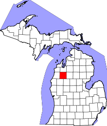 | |
| Villages | ||
| Charter township | ||
| General law townships | ||
| CDPs | ||
| Other unincorporated communities | ||
This article is issued from
Wikipedia.
The text is licensed under Creative Commons - Attribution - Sharealike.
Additional terms may apply for the media files.