Wawona Tunnel
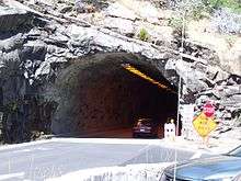 The east end of the tunnel | |
| Overview | |
|---|---|
| Location | Yosemite Valley, Yosemite National Park, Mariposa County, California, USA |
| Coordinates | 37°42′57″N 119°41′09″W / 37.71583°N 119.68583°WCoordinates: 37°42′57″N 119°41′09″W / 37.71583°N 119.68583°W |
| Route |
|
| Operation | |
| Opened | 1933 |
| Owner | National Park Service |
| Toll | $2.50 |
| Technical | |
| Length | 4,233 feet (1,290 m) |
| No. of lanes | two lanes total, one in each direction |
The Wawona Tunnel is a toll tunnel in Yosemite National Park. It, and Tunnel View just beyond its east portal, were completed in 1933.[1][2]
Route
Wawona Tunnel was bored through solid granite bedrock, and carries Wawona Road through a granite mountain on the south side of the Merced River.[3] It is located on one of the three main roads providing access to Yosemite Valley, the most visited section of the park. Wawona Road becomes California State Route 41 on exiting the park. After passing through the tunnel, when leaving Yosemite Valley, Wawona Road continues to Chinquapin Junction with Glacier Point Road at Badger Pass, and reaches an elevation of 6,039 feet (1,841 m) above sea level. A toll plaza was constructed on the southwest end of the tunnel in 2018 as the National Park Service was in significant debt after the Ferguson Fire and the construction of a rockshed underneath the Ferguson Slide area. A cash-only toll of $2.50 is charged in both directions, FasTrak is not accepted.
Specifications
At 4,233 feet (1,290 m) long Wawona Tunnel is the longest highway tunnel in California.[2][4]
A $1.5 million federal highway contract to repair the tunnel's ventilation and electrical systems, and a separate contract to upgrade visitor services at Tunnel View, was completed in 2008.[1]
Scenery
The Wawona Tunnel features in a famous monochrome photograph by Ansel Adams: From Wawona Tunnel, Winter, Yosemite, about 1935.[5]
See also
References
- 1 2 Leonnig, Carol D. (May 3, 2008). "Yosemite's Wawona Tunnel could be dangerous". San Francisco Chronicle. Retrieved 10 November 2012.
- 1 2 Rabold, John (November 2010). "Yosemite FAQs". A Guide to Yosemite National Park. Retrieved 10 November 2012.
- ↑ Travis, Virginia. "Yosemite National Park: Wawona Tunnel". Retrieved 10 November 2012.
- ↑ The long Devil's Slide Tunnel in Pacifica, California, scheduled to open in 2013, is 4,149 feet (1,265 m) long; Dot.ca.gov/dist4: Devil's Slide; The Caldecott Tunnel in Oakland, California is 3,771 feet (1,149 m) long. Both measured in their longest bores).
- ↑ "Ansel Adams: Photography from the Mountains to the Sea exhibition opens in London". The Guardian. 9 November 2012. Retrieved 10 November 2012.
External links
| Wikimedia Commons has media related to Wawona Tunnel. |
- Driving through the Wawona Tunnel, YouTube
- Vehicle Restrictions, National Park Service
- Photo of Department of Agriculture Survey Plaque — dated 1936 and giving the tunnel's length as 4358.91 feet.
- Photo of ventilation fans, The Digital Ark Corporation
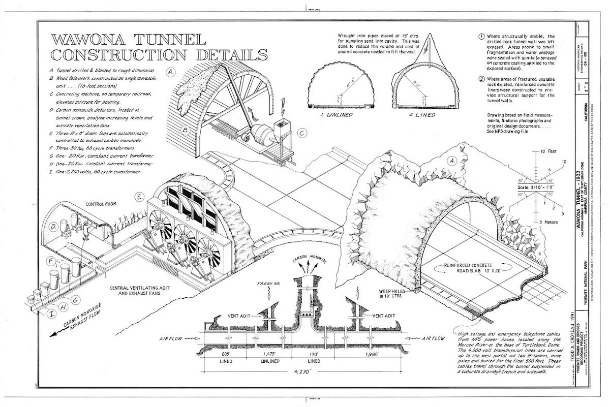
- Wawona tunnel construction details (graphic), Library of Congress records (from yosemitenews.info/forum)
- Detailed map of tunnel and side tunnels from yosemitenews.info/forum
- Building the National Parks: Historic Landscape Design and Construction, Professor Linda Flint McClelland, The Johns Hopkins University Press, 18 Nov 1997, ISBN 978-0801855832 (Google Books)