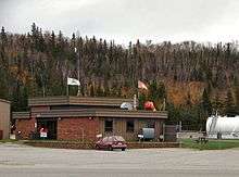
Wawa Airport
| Wawa Airport | |||||||||||
|---|---|---|---|---|---|---|---|---|---|---|---|
 | |||||||||||
| Summary | |||||||||||
| Airport type | Public | ||||||||||
| Operator | The Corporation of the Municipality of Wawa | ||||||||||
| Location | Wawa, Ontario | ||||||||||
| Time zone | EST (UTC−05:00) | ||||||||||
| • Summer (DST) | EDT (UTC−04:00) | ||||||||||
| Elevation AMSL | 944 ft / 288 m | ||||||||||
| Coordinates | 47°58′01″N 084°47′11″W / 47.96694°N 84.78639°WCoordinates: 47°58′01″N 084°47′11″W / 47.96694°N 84.78639°W | ||||||||||
| Map | |||||||||||
 CYXZ Location in Ontario | |||||||||||
| Runways | |||||||||||
| |||||||||||
Wawa Airport, (IATA: YXZ, ICAO: CYXZ), is located 1.7 nautical miles (3.1 km; 2.0 mi) south southwest of Wawa, Ontario, Canada.
References
- ↑ Canada Flight Supplement. Effective 0901Z 19 July 2018 to 0901Z 13 September 2018.
- ↑ Synoptic/Metstat Station Information
External links
- Past three hours METARs, SPECI and current TAFs for Wawa Airport from Nav Canada as available.
| By name | |
|---|---|
| By location indicator | |
| By province/territory | |
| By area | |
| National Airports System | |
| Related | |
| |
This article is issued from
Wikipedia.
The text is licensed under Creative Commons - Attribution - Sharealike.
Additional terms may apply for the media files.