Waucoba Mountain
| Waucoba Mountain | |
|---|---|
 Waucoba Mountain from the northeast | |
| Highest point | |
| Elevation | 11,128 ft (3,392 m) NAVD 88[1] |
| Prominence | 3,923 ft (1,196 m) [2] |
| Listing | |
| Coordinates | 37°01′19″N 118°00′28″W / 37.022030544°N 118.007764294°WCoordinates: 37°01′19″N 118°00′28″W / 37.022030544°N 118.007764294°W [1] |
| Geography | |
 Waucoba Mountain Location in California | |
| Location | Inyo County, California, U.S. |
| Parent range | Inyo Mountains |
| Topo map | USGS Waucoba Mountain |
Waucoba Mountain with an elevation of 11,128 feet (3,392 m) is the highest peak in the Inyo Mountains of eastern California. It is in the Inyo Mountains Wilderness and the Inyo National Forest. It has a clean prominence of 3,923 feet (1,196 m).[2]
"Waucoba" is a name derived from a Native American language meaning "pine trees".[5]
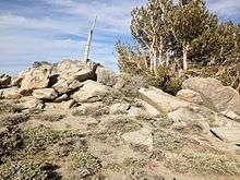
Waucoba Mountain Summit
References
- 1 2 "Waucoba". NGS data sheet. U.S. National Geodetic Survey. Retrieved 2016-08-08.
- 1 2 "Waucoba Mountain, California". Peakbagger.com. Retrieved 2016-08-08.
- ↑ "Desert Peaks Section List" (PDF). Angeles Chapter, Sierra Club.
- ↑ "Great Basin Peaks List". Toiyabe Chapter, Sierra Club. Retrieved 2016-08-08.
- ↑ Sullivan, Ron (December 7, 2002). "Roots of native names". SFGate. Retrieved 27 March 2018.
External links
This article is issued from
Wikipedia.
The text is licensed under Creative Commons - Attribution - Sharealike.
Additional terms may apply for the media files.