Waterford, Mississippi
| Waterford | |
|---|---|
| Unincorporated community | |
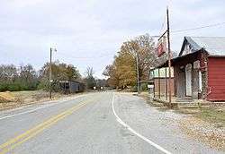 Potts Camp Road in Waterford | |
 Waterford  Waterford | |
| Coordinates: 34°38′51″N 89°27′26″W / 34.64750°N 89.45722°WCoordinates: 34°38′51″N 89°27′26″W / 34.64750°N 89.45722°W | |
| Country | United States |
| State | Mississippi |
| County | Marshall |
| Elevation | 413 ft (126 m) |
| Population | 84 |
| Time zone | UTC-6 (CST) |
| • Summer (DST) | UTC-5 (CDT) |
| ZIP codes | 38685 |
| Area code(s) | 662 |
| GNIS feature ID | 695101[1] |
Waterford is an unincorporated community located in Marshall County, Mississippi, United States.[1] It is a small town located between Holly Springs and Oxford on Highway 7. The city once had several small stores, shops and a cotton mill. Currently there is only one store. The city is also the home of Wall Doxey State Park and is also a part of the Mississippi National Forest.
Waterford is a rural farming community. Its population according to U.S. Beacon in 2000 was 84.
References
Municipalities and communities of Marshall County, Mississippi, United States | ||
|---|---|---|
| City | 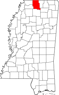 | |
| Towns | ||
| Unincorporated communities |
| |
This article is issued from
Wikipedia.
The text is licensed under Creative Commons - Attribution - Sharealike.
Additional terms may apply for the media files.