Waria, India
| Waria | |
|---|---|
| neighbourhood | |
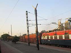 Waria railway station platform | |
 Waria Location in West Bengal, India  Waria Waria (India) | |
| Coordinates: 23°32′20″N 87°14′47″E / 23.538809°N 87.246526°ECoordinates: 23°32′20″N 87°14′47″E / 23.538809°N 87.246526°E | |
| Country |
|
| State | West Bengal |
| Government | |
| • Body | Durgapur Municipal Corporation |
| Languages | |
| • Official | Bengali, English |
| Time zone | UTC+5:30 (IST) |
| PIN | 713203, 713207 |
| Telephone code | 0343 |
| Vehicle registration | WB-39, WB-40 |
| Lok Sabha constituency | Barddhaman-Durgapur |
| Vidhan Sabha constituency | Durgapur Paschim |
| Civic agency | Durgapur Municipal Corporation |
| Climate | hot and breezy (Köppen) |
| Website |
wb |
Waria is a locality in Durgapur of West Bengal, India. It is located between the neighbourhoods of Mayabazar and Andal. The river Damodar flows to its south. The Durgapur Steel Plant and the Durgapur Thermal Power Station of the Damodar Valley Corporation are close to the Waria railway station.[1]
References
This article is issued from
Wikipedia.
The text is licensed under Creative Commons - Attribution - Sharealike.
Additional terms may apply for the media files.