Wards of Glasgow
| Wards of Glasgow | |
|---|---|
| Electoral Districts (Wards) | |
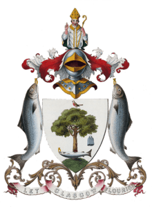
 This is the coat of arms for the City of Glasgow Corporation. Two local authority’s have followed the Corporation and had their own version of the city coat of arms. The City Of Glasgow District Council replaced the Corporation and the current authority the City Of Glasgow Council or Glasgow City Council replaced the district council. | |
| Country |
Scotland |
| City | Glasgow |
| Council | Glasgow City Council |
| Area[1] | |
| • Total | 176 km2 (68 sq mi) |
| Population [2] | |
| • Total | 606,340 |
| • Density | 3,400/km2 (8,900/sq mi) |
The City of Glasgow is divided into a number of wards. These electoral districts, as they are also known, are used to elect councillors to Glasgow City Council. The council, composed of the elected members from each ward, provides local government services to the City of Glasgow.
There are 23 wards situated within the perimeters of Glasgow City Council. Each one elects 3 or 4 councillors every five years in the Scottish local council elections. The most recent elections were held in 2017.
Glasgow City Council is one of the 32 council areas for Scotland (each council containing a number of wards). The boundaries for all Scottish council areas and their sub divisional wards are regulated and regularly reviewed by the Local Government Boundary Commission for Scotland.
Map
The following is a map of the current party representation for each ward, shown within the area served by Glasgow City Council.
| Party colour | Party name |
| Conservative | |
| Scottish Green | |
| Labour | |
| Scottish National Party | |

List of Wards
The following is a list of each Glasgow ward and its population data.

| Ward Number | Ward Name | Location with respect to the River Clyde |
Area [3] (km²) |
Population [4] (2015 estimate) |
Density (inh./km²) |
|---|---|---|---|---|---|
| 1. | Linn | South | 11.10 | 29,575 | 2,664 |
| 2. | Newlands/Auldburn | South | 9.93 | 23,144 | 2,330 |
| 3. | Greater Pollok | South | 11.70 | 30,729 | 2,626 |
| 4. | Cardonald | South | 7.27 | 29,639 | 4,076 |
| 5. | Govan | South | 8.26 | 26,769 | 3,240 |
| 6. | Pollokshields | South | 6.29 | 27,983 | 4,448 |
| 7. | Langside | South | 4.67 | 29,060 | 6,222 |
| 8. | Southside Central | South | 4.29 | 25,266 | 5,889 |
| 9. | Calton | North | 6.38 | 27,460 | 4,304 |
| 10. | Anderston/City/Yorkhill | North | 5.75 | 30,184 | 5,249 |
| 11. | Hillhead | North | 2.92 | 25,411 | 8,702 |
| 12. | Victoria Park | North | 4.41 | 20,950 | 4,750 |
| 13. | Garscadden/Scotstounhill | North | 5.94 | 30,565 | 5,145 |
| 14. | Drumchapel/Anniesland | North | 7.30 | 29,432 | 4,031 |
| 15. | Maryhill | North | 4.99 | 22,244 | 4,457 |
| 16. | Canal | North | 14.40 | 25,000 | 1,736 |
| 17. | Springburn/Robroyston | North | 9.50 | 27,237 | 2,867 |
| 18. | East Centre | North | 6.36 | 27,991 | 4,401 |
| 19. | Shettleston | North | 10.40 | 25,806 | 2,481 |
| 20. | Baillieston | North | 10.10 | 21,663 | 2,144 |
| 21. | North East | North | 14.90 | 20,457 | 1,372 |
| 22. | Dennistoun | North | 5.21 | 20,861 | 4,004 |
| 23. | Partick East/Kelvindale | North | 3.91 | 28,914 | 7,394 |
| Σ | Total (Glasgow City) | Central | 175.98 | 606,340 | 3,445 |
References
- ↑ (Total of all wards) https://mapit.mysociety.org/area/2579.html - KML file imported to mapping software
- ↑ [2015] (Total of all wards) http://statistics.gov.scot/data/population-estimates-current-geographic-boundaries - Council Area (Glasgow City)
- ↑ "Glasgow City Council wards - MapIt". mapit.mysociety.org. Retrieved 18 May 2017.
- ↑ Population statistics for each ward - https://www.glasgow.gov.uk/index.aspx?articleid=18820