Walhonding, Guernsey County, Ohio
| Walhonding, Ohio | |
|---|---|
| Unincorporated community | |
 Walhonding  Walhonding | |
| Coordinates: 39°54′16″N 81°29′50″W / 39.90444°N 81.49722°WCoordinates: 39°54′16″N 81°29′50″W / 39.90444°N 81.49722°W | |
| Country | United States |
| State | Ohio |
| County | Guernsey |
| Township | Valley |
| Area | |
| • Water | 0.0 sq mi (0.0 km2) |
| Elevation | 833 ft (254 m) |
| Time zone | UTC-5 (Eastern (EST)) |
| • Summer (DST) | UTC-4 (EDT) |
| GNIS feature ID | 1065447[1] |
Walhonding is an unincorporated community and coal town in southeastern Valley Township, Guernsey County, Ohio, United States.
References
Municipalities and communities of Guernsey County, Ohio, United States | ||
|---|---|---|
| City | 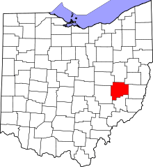 | |
| Villages | ||
| Townships | ||
| CDPs | ||
| Unincorporated communities | ||
| Footnotes | ‡This populated place also has portions in an adjacent county or counties | |
This article is issued from
Wikipedia.
The text is licensed under Creative Commons - Attribution - Sharealike.
Additional terms may apply for the media files.