Vydrany
| Vydrany Nemeshodos | |
|---|---|
| village | |
 Location of the village | |
| Coordinates: 48°01′00″N 17°35′15″E / 48.01667°N 17.58750°ECoordinates: 48°01′00″N 17°35′15″E / 48.01667°N 17.58750°E | |
| Country |
|
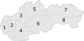
| Region | Trnava |
| District | Dunajská Streda |
| First written mention | 1245 |
| Named for | „Noble Beaver” |
| Government[1][2] | |
| • Mayor | László Balódi (Ind.) |
| Area | |
| • Total | 16.049 km2 (6.197 sq mi) |
| Elevation | 116 m (381 ft) |
| Population (2001)[3] | |
| • Total | 1,390 |
| • Estimate (2008) | 1,499 |
| • Density | 93/km2 (240/sq mi) |
| Ethnicity[3] | |
| • Hungarians | 85,40 % |
| • Slovaks | 12,23% |
| Time zone | UTC+1 (EET) |
| • Summer (DST) | UTC+2 (EEST) |
| Postal Code | 930 16 |
| Area code(s) | +421 31 |
| Website |
www |
Vydrany (Hungarian: Hodos, pronounced [ˈhodoʃ]) is a village and municipality in the Dunajská Streda District in the Trnava Region of south-west Slovakia. .
Names and etymology
The Hungarian name Hodos (the current name in the language of the national minority[4]) and the former Slovak name Hodoš derive from Hungrian appellative hód - a beaver. After the abolition of serfdom and some noble privileges in 1848, the village was renamed to Nemeshodos (nemes - noble). In 1948, the village was renamed to Vydrany. This name comes from a translation mistake. In Slovak vydra means an otter.[5].
History
In the 9th century, the territory of Vydrany became part of the Kingdom of Hungary. The village was first recorded in 1245 by its Hungarian name as Hodus. At the end of the 13th century, it was the estate of the Hodossy family, later it became a village of noble families. In the 19th century, the village was the estate of the local Vermes family.
Until the end of World War I, the village was part of Hungary and fell within the Dunaszerdahely district of Pozsony County. After the Austro-Hungarian army disintegrated in November 1918, Czechoslovak troops occupied the area. After the Treaty of Trianon of 1920, the village became officially part of Czechoslovakia. In November 1938, the First Vienna Award granted the area to Hungary and it was held by Hungary until 1945. After Soviet occupation in 1945, Czechoslovak administration returned and the village became officially part of Czechoslovakia in 1947.
Demography
In 1910, the village had 997, for the most part, Hungarian inhabitants. At the 2001 Census the recorded population of the village was 1390 while an end-2008 estimate by the Statistical Office had the villages's population also as 1499. As of 2001, 85.40 per cent of its population was Hungarian while 12.23 per cent was Slovak.
Roman Catholicism is the majority religion of the village, its adherents numbering 56.04% of the total population.[3]
References
- ↑ "Local election results by the Statistical Office of the Slovak Republic, December 2006". Archived from the original on 2011-08-11. Retrieved 2010-10-14.
- ↑ Local election 2010 results by the Statistical Office of the Slovak Republic Archived 2011-08-11 at the Wayback Machine.
- 1 2 3 "Urban and Municipal Statistics MOŠ". Archived from the original on 2011-02-26.
- ↑ "Príloha k nariadeniu vlády č. 221/1999 Z. z.: Zoznam obcí v ktorých občania Slovenskej republiky patriaci k maďarskej národnostnej menšine tvoria najmenej 20 % obyvateľstva" (PDF). Retrieved October 27, 2017.
- ↑ Horňanský, Imrich (2016). "Z osudov slovenských geografických názvov". Slovenské slovo (in Slovak) (16).
External links
- Municipality website
- The village on the map of Slovakia
- Local Reformed Church community website (in Hungarian)