Kostolné Kračany
| Kostolné Kračany Egyházkarcsa | |||
|---|---|---|---|
| village | |||
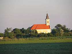 The church of the village | |||
| |||
 Location of the village | |||
| Coordinates: 47°59′01″N 17°34′36″E / 47.98361°N 17.57667°ECoordinates: 47°59′01″N 17°34′36″E / 47.98361°N 17.57667°E | |||
| Country |
| ||
| Region | Trnava | ||
| District | Dunajská Streda | ||
| First written mention | 1215 | ||
| Named for | the Hungarian Karcsa clan | ||
| Government | |||
| • Mayor | László Gódány[1][2] (Most-Híd, Party of the Hungarian Coalition) | ||
| Area | |||
| • Total | 13.96 km2 (5.39 sq mi) | ||
| Elevation | 116 m (381 ft) | ||
| Population (2001)[3] | |||
| • Total | 1,162 | ||
| • Estimate (2008) | 1,293 | ||
| • Density | 90/km2 (200/sq mi) | ||
| Ethnicity[3] | |||
| • Hungarians | 92,77% | ||
| • Slovakians | 5,51% | ||
| Time zone | UTC+1 (EET) | ||
| • Summer (DST) | UTC+2 (EEST) | ||
| Postal Code | 930 03 | ||
| Area code(s) | +421 31 | ||


Kostolné Kračany (Hungarian: Egyházkarcsa, Hungarian pronunciation:[ˈɛɟhaːzkɒrtʃɒ]) is a village and municipality in the Dunajská Streda District in the Trnava Region of south-west Slovakia.
Component villages
The village also administers 5 other villages:
| In Slovak | In Hungarian |
|---|---|
| Amadeho Kračany | Amadékarcsa |
| Kynceľove Kračany | Göncölkarcsa |
| Moravské Kračany | Mórockarcsa |
| Pinkove Kračany | Pinkekarcsa |
| Šipošovske Kračany | Siposkarcsa |
Geography
The municipality lies at an altitude of 119 metres, 5 km southwest of Dunajská Streda, and covers an area of 13.916 km².
History
In the 9th century, the territory of Kostolné Kračany became part of the Kingdom of Hungary. In historical records the village was first mentioned in 1215 as Corcha. Its first church was consecrated to Saint Bartholomew before 1249. However, the settlement is considered to originate from the era of the Hungarian conquest of the Carpathian Basin as the structure of the village reflects the ecclesiastical system as organised by King St Stephen of Hungary. The king ordered that all 10 villages must build a church, the villages named Karcha build the church in this village whose name in Hungarian means Church Karcha.
In the 14th century, it consisted of the following villages: Egyházaskarcha (1351), Remegkarcha (1355), Diákkarcha (1357), Barthalkarcha (1377) Lászlókarcha (1377) és Lucakarcha (1467). In 1561, the people of the village converted to the Protestant Reformed church, and only in 1729 was the Catholic congregation re-established. During the 16th and 17th centuries, the village was under the patronage of the Somogyi family. The population, 62 in 1840, grew to 80 by 1910. Ethnically, the population was predominantly Hungarian. Until the Treaty of Trianon, it was part of Pozsony county.
Demography
According to the 2001 census, its total population was 1162, including 1078 ethnic Hungarians (92,77%) and 64 ethnic Slovaks (5,51%). As of December 31, 2008 the estimated resident population was 1293.[3]
See also
References
- ↑ Election results 2006 Archived 2012-03-08 at the Wayback Machine.
- ↑ Local election 2010 results by the Statistical Office of the Slovak Republic Archived 2011-08-11 at the Wayback Machine.
- 1 2 3 "Institute of Informatics and Statistics". Archived from Institute of Informatics and Statistics the original Check
|url=value (help) on 2011-02-26.
Genealogical resources
The records for genealogical research are available at the state archive "Statny Archiv in Bratislava, Slovakia"
- Roman Catholic church records (births/marriages/deaths): 1673-1935 (parish A)