Vuren
| Vuren | ||
|---|---|---|
| Village | ||
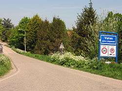 Entering the village | ||
| ||
 | ||
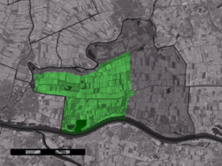 The village centre (dark green) and the statistical district (light green) of Vuren in the municipality of Lingewaal. | ||
| Coordinates: 51°49′28″N 5°2′48″E / 51.82444°N 5.04667°ECoordinates: 51°49′28″N 5°2′48″E / 51.82444°N 5.04667°E | ||
| Country | Netherlands | |
| Province | Gelderland | |
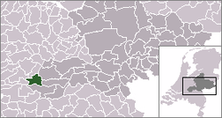
| Municipality | Lingewaal | |
| Population (2001) | ||
| • Total | 1,575 | |
| Time zone | UTC+1 (CET) | |
| • Summer (DST) | UTC+2 (CEST) | |
Vuren is a village in the Dutch province of Gelderland. It is a part of the municipality of Lingewaal, and is located about 5 km east of Gorinchem.
Vuren was a separate municipality until 1986, when it merged with Asperen, Herwijnen, and Heukelum including Spijk. The new municipality was originally called "Vuren", but the name changed to "Lingewaal" in 1987. Before 1816, the municipality of Vuren was named "Dalem".[1]
In 2001, the village of Vuren had 1575 inhabitants. The built-up area of the village was 0.47 km², and contained 608 residences.[2] The statistical area "Vuren", which also can include the peripheral parts of the village, as well as the surrounding countryside, has a population of around 2090.[3]
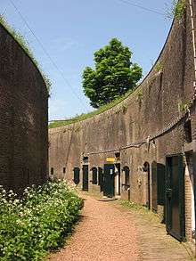
The fort at Vuren formed part of the defensive Hollandic Water Line.

Trivia
- It is possible that the clan of van Vuuren, originated from here, despite the modern majority of the clan being based in South Africa
References
- ↑ Ad van der Meer and Onno Boonstra, Repertorium van Nederlandse gemeenten, KNAW, 2006.
- ↑ Statistics Netherlands (CBS), Bevolkingskernen in Nederland 2001. (Statistics are for the continuous built-up area).
- ↑ Statistics Netherlands (CBS), Statline: Kerncijfers wijken en buurten 2003-2005. As of 1 January 2005.
External links
- J. Kuyper, Gemeente Atlas van Nederland, 1865-1870, "Vuren". Map of the former municipality, around 1868.
- Vuren village homepage