Vranov nad Topľou District
| Vranov nad Topľou District | |
|---|---|
| District | |
 | |
| Country | Slovakia |
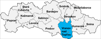
| Region (kraj) | Prešov Region |
| Area | |
| • Total | 769 km2 (297 sq mi) |
| Population (2001) | |
| • Total | 76,504 |
| • Density | 99/km2 (260/sq mi) |
| Time zone | UTC+1 (CET) |
| • Summer (DST) | UTC+2 (CEST) |
Vranov nad Topľou District (Slovak: okres Vranov nad Topľou) is a district in the Prešov Region of eastern Slovakia. Until 1918, the district was mostly part of the county of Kingdom of Hungary of Zemplén, apart from an area around Hanušovce nad Topľou which formed part of the county of Sáros.
Municipalities
- Babie
- Banské
- Benkovce
- Bystré
- Cabov
- Čaklov
- Čičava
- Čierne nad Topľou
- Davidov
- Detrík
- Dlhé Klčovo
- Ďapalovce
- Ďurďoš
- Giglovce
- Girovce
- Hanušovce nad Topľou
- Hencovce
- Hermanovce nad Topľou
- Hlinné
- Holčíkovce
- Jasenovce
- Jastrabie nad Topľou
- Juskova Voľa
- Kamenná Poruba
- Kladzany
- Komárany
- Kučín
- Kvakovce
- Majerovce
- Malá Domaša
- Matiaška
- Medzianky
- Merník
- Michalok
- Nižný Hrabovec
- Nižný Hrušov
- Nižný Kručov
- Nová Kelča
- Ondavské Matiašovce
- Pavlovce
- Petkovce
- Petrovce
- Piskorovce
- Poša
- Prosačov
- Radvanovce
- Rafajovce
- Remeniny
- Rudlov
- Ruská Voľa
- Sačurov
- Sečovská Polianka
- Sedliská
- Skrabské
- Slovenská Kajňa
- Soľ
- Štefanovce
- Tovarné
- Tovarnianska Polianka
- Vavrinec
- Vechec
- Vlača
- Vranov nad Topľou
- Vyšný Kazimír
- Vyšný Žipov
- Zámutov
- Zlatník
- Žalobín
Districts of Prešov Region | ||
|---|---|---|
Coordinates: 48°53′25″N 21°40′59″E / 48.89028°N 21.68306°E
This article is issued from
Wikipedia.
The text is licensed under Creative Commons - Attribution - Sharealike.
Additional terms may apply for the media files.