Vlasti
| Vlasti Βλάστη | |
|---|---|
_mountain_-_Ptolemaida%2C_Kozani_prefecture%2C_Greece.png) Vlasti with Askio in the background. | |
 Vlasti Location within the regional unit 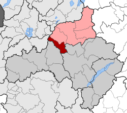 | |
| Coordinates: 40°27′N 21°31′E / 40.450°N 21.517°ECoordinates: 40°27′N 21°31′E / 40.450°N 21.517°E | |
| Country | Greece |
| Administrative region | West Macedonia |
| Regional unit | Kozani |
| Municipality | Eordaia |
| • Municipal unit | 72.089 km2 (27.834 sq mi) |
| Elevation | 1,180 m (3,870 ft) |
| Population (2011)[1] | |
| • Municipal unit | 274 |
| • Municipal unit density | 3.8/km2 (9.8/sq mi) |
| Time zone | UTC+2 (EET) |
| • Summer (DST) | UTC+3 (EEST) |
| Postal code | 500 09 |
| Area code(s) | +30-2463-xxx-xxx |
| Vehicle registration | KZ |
Vlasti (Greek: Βλάστη, before 1927: Βλάτση - Vlatsi,[2] Aromanian: Blatsa) is an Aromanian (Vlach) village and a community of the Eordaia municipality.[3] Before the 2011 local government reform it was an independent community.[2] The 2011 census recorded 274 inhabitants in the village.[1] The community of Vlasti covers an area of 72.089 km2.[4]
History
The first settlement was established in the 15th century and received an influx of Vlach refugees from Grammos and Moschopoli in the 18th century. The public buildings and the houses which still today adorn Vlasti reflect the flourishing of this village in the 19th century.
Geography
Located at the heart of western Macedonia, it is girdled by the massifs of Mt Mouriki which serves as a home not only to the brown bear (Ursus arctos), but also to a large number of rare birds, including the short-toed eagle (Circaetus gallicus), the Egyptian vulture (Neophron percnopterus) and the long-legged buzzard (Buteo rufinus).
Tourism
The village bustles with life in summer as it is then that the Earth Festival is organized. It comprises a series of ecological and at the same time joyful events whose objective is to inform and sensitize people showing them the need to respect natural environment. Moreover, visitors have the chance to come into contact with the locals, experience their hospitality and participate with them in these jolly festivities. Vlasti serves a starting point for fascinating, enjoyable routes either to Mt Mouriki and its shelter or to neighbouring regions. There is good infrastructure to support the touristic development of the place with hotels, restaurants and bars.
See also
References
- 1 2 "Απογραφή Πληθυσμού - Κατοικιών 2011. ΜΟΝΙΜΟΣ Πληθυσμός" (in Greek). Hellenic Statistical Authority.
- 1 2 EETAA local government changes
- ↑ Kallikratis law Greece Ministry of Interior (in Greek)
- ↑ "Population & housing census 2001 (incl. area and average elevation)" (PDF) (in Greek). National Statistical Service of Greece.