Virgil (CDP), New York
| Virgil, New York | |
|---|---|
| Census-designated place | |
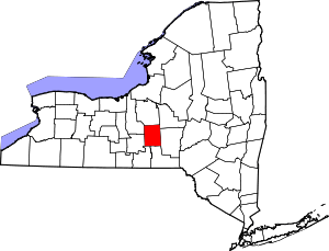
 Virgil Location within the state of New York | |
| Coordinates: 42°30′38″N 76°11′40″W / 42.51056°N 76.19444°WCoordinates: 42°30′38″N 76°11′40″W / 42.51056°N 76.19444°W | |
| Country | United States |
| State | New York |
| County | Cortland |
| Town | Virgil |
| Area | |
| • Total | 0.9 sq mi (2.3 km2) |
| • Land | 0.9 sq mi (2.3 km2) |
| • Water | 0.0 sq mi (0.0 km2) |
| Elevation | 1,410 ft (430 m) |
| Time zone | UTC-5 (Eastern (EST)) |
| • Summer (DST) | UTC-4 (EDT) |
| ZIP code | 13045 |
| FIPS code | 36-77585 |
Virgil is a hamlet and census-designated place (CDP) in the town of Virgil, Cortland County, New York, United States. The CDP was designated after the 2010 census, so no population figure is yet available.
Geography
The hamlet of Virgil is located in the west-central part of the town of Virgil, in the valley of Virgil Creek, a west-flowing stream which is part of the Cayuga Lake watershed. New York State Routes 392 and 215 intersect at the center of the hamlet. Route 392 leads east 7 miles (11 km) to U.S. Route 11 in Messengerville, and west 6 miles (10 km) to NY Route 13 in the village of Dryden, while Route 215 leads north 6 miles (10 km) to Cortland, the county seat.
According to the United States Census Bureau, the Virgil CDP has a total area of 0.89 square miles (2.3 km2), all land.[1]
References
- ↑ "2014 U.S. Gazetteer Files: Places: New York". U.S. Census Bureau, Geography Division. Archived from the original on December 13, 2014. Retrieved December 17, 2014.