Villa, Norway
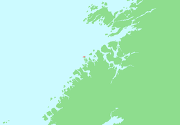 | |
 Villa Location of the island  Villa Villa (Norway) | |
| Geography | |
|---|---|
| Location | Trøndelag, Norway |
| Coordinates | 64°32′49″N 10°41′34″E / 64.5470°N 10.6929°ECoordinates: 64°32′49″N 10°41′34″E / 64.5470°N 10.6929°E |
| Area | 1.2 km2 (0.46 sq mi) |
| Length | 2 km (1.2 mi) |
| Width | 1 km (0.6 mi) |
| Coastline | 8 km (5 mi) |
| Highest elevation | 106 m (348 ft) |
| Highest point | Villafjellet |
| Administration | |
|
Norway | |
| County | Trøndelag |
| Municipality | Flatanger |
| Demographics | |
| Population | 0 |
Villa is an island in the municipality of Flatanger in Trøndelag county, Norway. The 1.2-square-kilometre (300-acre) island lies in the Folda sea about 1.65 kilometres (1.03 mi) northwest of the village of Lauvsnes on the mainland and about 5 kilometres (3.1 mi) west of the island of Bjørøya.[1] The Villa Lighthouse is located on the western part of the island. The island had some permanent residents until the 1960s, but now it is uninhabited.
Large parts of the island consists of rocky mountains and rocks, but it also has bogs and heather areas and offers a rich flora, with some rare plants such as the yellow water-lily.
See also
References
This article is issued from
Wikipedia.
The text is licensed under Creative Commons - Attribution - Sharealike.
Additional terms may apply for the media files.