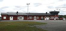
Vilhelmina Airport
| Vilhelmina Airport | |||||||||||
|---|---|---|---|---|---|---|---|---|---|---|---|
 | |||||||||||
| Summary | |||||||||||
| Airport type | Public | ||||||||||
| Operator | Vilhelmina Municipality | ||||||||||
| Location | Vilhelmina | ||||||||||
| Elevation AMSL | 1,140 ft / 347 m | ||||||||||
| Coordinates | 64°34′44″N 016°50′00″E / 64.57889°N 16.83333°ECoordinates: 64°34′44″N 016°50′00″E / 64.57889°N 16.83333°E | ||||||||||
| Runways | |||||||||||
| |||||||||||
| Statistics (2009) | |||||||||||
| |||||||||||
Vilhelmina Airport (IATA: VHM, ICAO: ESNV) is an airport in the village of Sagadal outside Vilhelmina, Sweden. The airport has recently been given an alternative name, South Lapland Airport.
Airlines and destinations
| Airlines | Destinations |
|---|---|
| Amapola Flyg | Lycksele, Stockholm–Arlanda (PSO) |
See also
References
- ↑ "Passagerarfrekvens" (PDF) (in Swedish). Swedish Transport Agency. Archived from the original (PDF) on 28 April 2011. Retrieved 28 April 2011.
- ↑ "Landningsfrekvens" (PDF) (in Swedish). Swedish Transport Agency. Archived from the original (PDF) on 28 April 2011. Retrieved 28 April 2011.
This article is issued from
Wikipedia.
The text is licensed under Creative Commons - Attribution - Sharealike.
Additional terms may apply for the media files.