Viera West, Florida
| Viera West, Florida | |
|---|---|
| CDP | |
| Coordinates: 28°14′51″N 80°44′16″W / 28.24750°N 80.73778°WCoordinates: 28°14′51″N 80°44′16″W / 28.24750°N 80.73778°W | |
| Country |
|
| State |
|
| County | Brevard |
| Area | |
| • Total | 9.0 sq mi (23.4 km2) |
| • Land | 8.9 sq mi (23.1 km2) |
| • Water | 0.04 sq mi (0.1 km2) |
| Elevation | 25 ft (8 m) |
| Population (2010) | |
| • Total | 6,641 |
| • Density | 740/sq mi (280/km2) |
| Time zone | UTC-5 (Eastern (EST)) |
| • Summer (DST) | UTC-4 (EDT) |
| GNIS feature ID | 1989257[1] |
Viera West is a census-designated place (CDP) in Brevard County, Florida, United States. The population was 6,641 at the 2010 census.[2] It forms a part of the larger unincorporated community of Viera and is part of the Palm Bay–Melbourne–Titusville Metropolitan Statistical Area.
History
The company developing West Viera gained state permission and county acquiescence to create a self-governing board that could raise taxes and sell bonds to pay for roads, water lines, pumping stations and other infrastructure needed to support the construction of 16,500 houses, apartments and condominiums. The company proved that development could fund itself.[3]
Geography
Viera West is located at 28°14′51″N 80°44′16″W / 28.24750°N 80.73778°W (28.2477, -80.7378),[4] to the west of Interstate 95.
According to the United States Census Bureau, the CDP has a total area of 9.0 square miles (23.4 km2), of which 8.9 square miles (23.1 km2) is land and 0.12 square miles (0.3 km2), or 1.47%, is water.[5]
See also
References
- ↑ "US Board on Geographic Names". United States Geological Survey. 2007-10-25. Retrieved 2008-01-31.
- ↑ "Profile of General Population and Housing Characteristics: 2010 Demographic Profile Data (DP-1): Viera West CDP, Florida". U.S. Census Bureau, American Factfinder. Retrieved January 31, 2012.
- ↑ Brevard County, Florida - By Wikipedians - Google Books. Books.google.com. Retrieved 31 January 2014.
- ↑ "US Gazetteer files: 2010, 2000, and 1990". United States Census Bureau. 2011-02-12. Retrieved 2011-04-23.
- ↑ "Geographic Identifiers: 2010 Demographic Profile Data (G001): Viera West CDP, Florida". U.S. Census Bureau, American Factfinder. Retrieved January 31, 2012.
Municipalities and communities of Brevard County, Florida, United States | ||
|---|---|---|
| Cities | 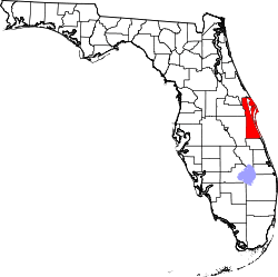 | |
| Towns | ||
| CDPs | ||
| Unincorporated communities | ||