Victoria Point, Queensland
| Victoria Point Redland City, Queensland | |||||||||||||||
|---|---|---|---|---|---|---|---|---|---|---|---|---|---|---|---|
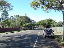 Colburn Avenue, 2014 | |||||||||||||||
| Population | 14,817 (2011 census)[1] | ||||||||||||||
| Postcode(s) | 4165 | ||||||||||||||
| Location | 33 km (21 mi) from Brisbane GPO | ||||||||||||||
| LGA(s) | Redland City | ||||||||||||||
| State electorate(s) | Redlands | ||||||||||||||
| Federal Division(s) | Bowman | ||||||||||||||
| |||||||||||||||
Victoria Point is a suburb in Redland City, Queensland, Australia.[2]
Geography
Victoria Point is approximately 33 kilometres (21 mi) south-east of Brisbane, the capital city of Queensland. It is primarily a residential area, but it also contains other public complexes and a ferry service to Coochiemudlo Island.
History
The Victoria Point public library opened in 2006.[3]
Amenities
The area also hosts the Eprapah, the Charles S. Snow Scout Environment Training Centre, an area of bushland for the environmental education for members of the Scout and Guide movements. Eprapah Creek separates Victoria Point to the north from the next suburb of Thornlands.
The headland has two boat ramps for boat entry to Moreton Bay and a Volunteer Marine Rescue unit. Beach areas include Thompson's Beach, a small child safe beach which has a very shallow slope allowing a long tide. Shopping facilities have expanded rapidly in the last few years, with now four supermarkets, cinema complex and many specialty shops and lakeside restaurants. The Redland City Council operates a public library at Lakeside Shopping Centre, 7-15 Bunker Road.[4] It also operates a mobile library service which visits Boat Street.[5]
Demographics
In the 2011 census, Victoria Point recorded a population of 14,817 people, 52.3% female and 47.7% male.[1] The median age of the Victoria Point population was 41 years, 4 years above the national median of 37. 74.8% of people living in Victoria Point were born in Australia. The other top responses for country of birth were England 8%, New Zealand 5.3%, South Africa 1.2%, Scotland 0.9%, Germany 0.5%. 92.6% of people spoke only English at home; the next most common languages were 0.5% German, 0.4% Afrikaans, 0.2% Finnish, 0.2% Dutch, 0.2% French.
Education
Victoria Point is home to four schools, two state and two private. Victoria Point State School is the local state primary school and Victoria Point State High School is the secondary school which has over 1200 students attending.[6]
St. Rita's Primary School, a Catholic school which runs its own church, is located on Benfer Road, the same road as Victoria Point State High School. Faith Lutheran College, was established as a primary school in 1982 with 64 students and 3 teachers, situated on Link Road. Subsequent expansion has seen the commencement of its Middle (Years 7-9) and Senior (Years 10-12) School Campus on Beveridge Road in the next suburb Thornlands. The founding grade of Year 12s graduated in November 2007.
Retirement villages
In 2007, there is a growing elderly population with six retirement villages currently in the suburb.
Media
Victoria Point is serviced by community radio station BayFM.
Sporting clubs
The Redland Australian Football Club, often referred to as the Redlands Bombers, competes in the North East Australian Football League[7] and provides many sporting opportunities for the area.
References
- 1 2 Australian Bureau of Statistics (31 October 2012). "Victoria Point (State Suburb)". 2011 Census QuickStats. Retrieved 16 February 2014.

- ↑ "Victoria Point - locality (entry 43637)". Queensland Place Names. Queensland Government. Retrieved 26 June 2017.
- ↑ "Public Libraries Statistical Bulletin 2016-17" (PDF). Public Libraries Connect. State Library of Queensland. November 2017. p. 15. Retrieved 17 January 2018.
- ↑ "Victoria Point Library". Public Libraries Connect. State Library of Queensland. 24 April 2014. Retrieved 17 January 2018.
- ↑ "Mobile Library". Redland City Council. Archived from the original on 31 January 2018. Retrieved 31 January 2018.
- ↑ "Victoria Point State High School - Annual Report 2006" (PDF). Retrieved 2008-03-17.
- ↑ North East Australian Football League
External links
| Wikimedia Commons has media related to Victoria Point, Queensland. |