Veruela, Agusan del Sur
| Veruela | |
|---|---|
| Municipality | |
| Municipality of Veruela | |
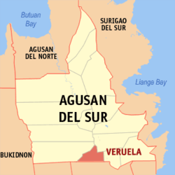 Map of Agusan del Sur with Veruela highlighted | |
.svg.png) Veruela Location within the Philippines | |
| Coordinates: 8°04′N 125°58′E / 8.07°N 125.96°ECoordinates: 8°04′N 125°58′E / 8.07°N 125.96°E | |
| Country |
|
| Region | Caraga (Region XIII) |
| Province | Agusan del Sur |
| District | 2nd District |
| Barangays | 20 (see Barangays) |
| Government [1] | |
| • Type | Sangguniang Bayan |
| • Mayor | Salimar T. Mondejar |
| • Electorate | 20,675 voters (2016) |
| Area [2] | |
| • Total | 385.45 km2 (148.82 sq mi) |
| Population (2015 census)[3] | |
| • Total | 43,706 |
| • Density | 110/km2 (290/sq mi) |
| Time zone | UTC+8 (PST) |
| ZIP code | 8509 |
| PSGC | 160313000 |
| IDD : area code | +63 (0)85 |
| Climate type | Tropical rainforest climate |
| Income class | 2nd municipal income class |
| Revenue (₱) | 131,765,136.39 (2016) |
| Native languages |
Agusan language Butuanon Cebuano Higaonon Tagalog |
| Website |
www |
Veruela, officially the Municipality of Veruela, (Cebuano: Lungsod sa Veruela; Tagalog: Bayan ng Veruela), is a 2nd class municipality in the province of Agusan del Sur, Philippines. According to the 2015 census, it has a population of 43,706 people.[3]
History
Veruela is considered the oldest town of upper Agusan del Sur. It was believed the name "Veruela" was derived from the word "virus", as the entire area was suffering from smallpox and cholera in the late 18th century when the Spanish missionaries encountered the tribe. From then on, the name Veruela existed out of the Spanish word La Verus.[4]
The Manobo tribes later moved to Manning, also known as Linongsuran along the Agusan River. In 1916 however, a great earthquake destroyed the settlement leaving no trace of the it, forcing the survivors to evacuate and reorganize themselves into another place, now the barangay poblacion of the municipality.[4]
In the 18th century, the Muslim tribes in Davao invaded the Manobos in Agusan. The Manobos fought against the Muslims. The first known leader of the inhabitants was Eladio Manguyod, a strong and influential datu of the Manobo tribe, who led his people to victory after a hard fought battle that drove the Muslims out of Agusan. It was also during those times when the tribe was converted into Christianity. The inhabitants owed their victories to Datu Manguyod as well as their patron, Saint John.[4]
Veruela became a municipality through Executive Order No. 147 proclaimed by President Diosdado Macapagal on March 31, 1965[5] during the term of Congressman Guillermo Sanchez, who once also served as mayor of the town. Since its formal creation as a municipality, Veruela had undergone a series of eight different administrations.
The municipality of Veruela has a silent dispute with the nearby province of Compostela Valley regarding the boundary between the two in Barangay Del Monte. The local governments are trying to solve the issue amicably.
Geography
Veruela is located at 8°04′N 125°58′E / 8.07°N 125.96°E.
According to the Philippine Statistics Authority, the municipality has a land area of 385.45 square kilometres (148.82 sq mi) [2] constituting 3.86% of the 9,989.52-square-kilometre- (3,856.98 sq mi) total area of Agusan del Sur.
Barangays
Veruela is politically subdivided into 20 barangays.[6]
| PSGC | Barangay | Population | ±% p.a. | |||
|---|---|---|---|---|---|---|
| 2015[3] | 2010[7] | |||||
| 160313013 | Anitap | 1.4% | 595 | 560 | 1.16% | |
| 160313014 | Bacay II | 2.5% | 1,085 | 994 | 1.68% | |
| 160313001 | Binongan | 4.0% | 1,735 | 1,477 | 3.11% | |
| 160313015 | Caigangan | 2.4% | 1,029 | 726 | 6.87% | |
| 160313016 | Candiis | 1.5% | 655 | 553 | 3.28% | |
| 160313002 | Del Monte | 5.4% | 2,375 | 2,260 | 0.95% | |
| 160313003 | Don Mateo | 3.3% | 1,452 | 1,269 | 2.60% | |
| 160313017 | Katipunan | 2.2% | 958 | 922 | 0.73% | |
| 160313004 | La Fortuna | 14.7% | 6,418 | 6,045 | 1.15% | |
| 160313005 | Limot | 2.2% | 973 | 1,104 | −2.38% | |
| 160313006 | Magsaysay | 3.7% | 1,628 | 1,563 | 0.78% | |
| 160313007 | Masayan | 3.9% | 1,726 | 1,430 | 3.65% | |
| 160313008 | Poblacion | 13.5% | 5,891 | 5,643 | 0.82% | |
| 160313009 | Sampaguita | 13.6% | 5,950 | 5,581 | 1.23% | |
| 160313010 | San Gabriel | 5.9% | 2,569 | 2,115 | 3.77% | |
| 160313018 | Santa Cruz | 2.4% | 1,059 | 1,021 | 0.70% | |
| 160313011 | Santa Emelia | 3.4% | 1,483 | 1,463 | 0.26% | |
| 160313019 | Sawagan | 2.5% | 1,099 | 1,214 | −1.88% | |
| 160313012 | Sinobong | 8.5% | 3,706 | 3,206 | 2.80% | |
| 160313020 | Sisimon | 3.0% | 1,320 | 1,311 | 0.13% | |
| Total | 43,706 | 40,457 | 1.48% | |||
Demographics
| Population census of Veruela | ||
|---|---|---|
| Year | Pop. | ±% p.a. |
| 1903 | 2,623 | — |
| 1918 | 1,522 | −3.56% |
| 1939 | 1,381 | −0.46% |
| 1948 | 1,528 | +1.13% |
| 1960 | 2,914 | +5.53% |
| 1970 | 6,626 | +8.55% |
| 1975 | 9,915 | +8.42% |
| 1980 | 13,991 | +7.13% |
| 1990 | 20,129 | +3.71% |
| 1995 | 28,185 | +6.51% |
| 2000 | 28,685 | +0.38% |
| 2007 | 36,862 | +3.52% |
| 2010 | 40,457 | +3.44% |
| 2015 | 43,706 | +1.48% |
| Source: Philippine Statistics Authority[3][7][8][9] | ||
In the 2015 census, Veruela had a population of 43,706.[3] The population density was 110 inhabitants per square kilometre (280/sq mi).
References
- ↑ "Municipality". Quezon City, Philippines: Department of the Interior and Local Government. Retrieved 31 May 2013.
- 1 2 "Province: Agusan del Sur". PSGC Interactive. Quezon City, Philippines: Philippine Statistics Authority. Retrieved 12 November 2016.
- 1 2 3 4 5 Census of Population (2015). "Caraga". Total Population by Province, City, Municipality and Barangay. PSA. Retrieved 20 June 2016.
- 1 2 3 "Municipality of Veruela". Province of Agusan del Sur. Provincial Information Management Office (PIMO). Archived from the original on 9 May 2013. Retrieved 19 October 2016.
- ↑ "Executive Order No. 147; Declaring Certain Municipal Districts in the Province of Agusan as Municipalities". Official Gazette of the Republic of the Philippines. 31 March 1965. Archived from the original on 14 October 2016. Retrieved 19 October 2016.
- ↑ "Municipal: Veruela, Agusan del Sur". PSGC Interactive. Quezon City, Philippines: Philippine Statistics Authority. Retrieved 8 January 2016.
- 1 2 Census of Population and Housing (2010). "Caraga". Total Population by Province, City, Municipality and Barangay. NSO. Retrieved 29 June 2016.
- ↑ Censuses of Population (1903–2007). "Caraga". Table 1. Population Enumerated in Various Censuses by Province/Highly Urbanized City: 1903 to 2007. NSO.
- ↑ "Province of Agusan del Sur". Municipality Population Data. Local Water Utilities Administration Research Division. Retrieved 17 December 2016.
Places adjacent to Veruela, Agusan del Sur | |
|---|---|