Vernon station
Vernon | |||||||||||
|---|---|---|---|---|---|---|---|---|---|---|---|
 Vernon station | |||||||||||
| Location | 4421 Long Beach Avenue, Los Angeles, CA 90021 | ||||||||||
| Coordinates | 34°00′13″N 118°14′36″W / 34.0037°N 118.2432°WCoordinates: 34°00′13″N 118°14′36″W / 34.0037°N 118.2432°W | ||||||||||
| Owned by | Metro | ||||||||||
| Line(s) |
| ||||||||||
| Platforms | 1 center platform | ||||||||||
| Tracks | 2 | ||||||||||
| Construction | |||||||||||
| Parking | none | ||||||||||
| Bicycle facilities | none | ||||||||||
| Disabled access | Yes | ||||||||||
| Other information | |||||||||||
| Status | in service | ||||||||||
| History | |||||||||||
| Opened | July 14, 1990 | ||||||||||
| Services | |||||||||||
| |||||||||||
Vernon is an at-grade light rail station on the Los Angeles County Metro Blue Line. [1]
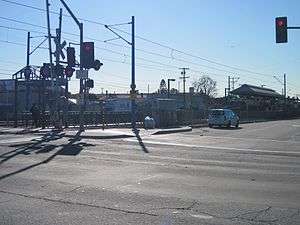
It has an island platform in the center media of Long Beach Avenue near the intersection of Vernon Avenue in South Los Angeles, a quarter of a mile from the border with Vernon.
Prior to the construction of the Blue Line, Vernon Avenue was an important junction on the lines of the Pacific Electric Railway. All lines from the Southern District, including the Long Beach, Watts, Whittier and San Pedro lines, stopped at Vernon Avenue, which was also a crossing with the Los Angeles Railway's V line.[2]
Under current plans, the station will also be served by the West Santa Ana Branch Transit Corridor, one of the Twenty-eight by '28 projects Metro aims to have online by the 2028 Summer Olympics.[3]
Station layout
| Platform | Southbound | ← |
| Island platform, doors will open on the left | ||
| Northbound | → | |
Service
Metro Rail service
Blue Line service hours are approximately from 4:00 AM until 1:00 AM daily.
Bus connections
- Metro Local: 105, 611
- Metro Rapid: 705
- LADOT DASH: Pueblo Del Rio, Southeast
Neighborhood and destinations
- Jefferson High School
- Pueblo De Rio Housing Complex
- Fred Roberts Park
- Ross Snyder Recreation Center
- Alameda Swap Meet
References
- ↑ "Blue Line station information" (PDF).
- ↑ "Pacific Electric Watts Line". Eagle Rock Historical Association.
- ↑ https://media.metro.net/projects_studies/westSantaAnaBranch/images/map_wsab_transitCorridor_2018-06.pdf