Vavta Vas
| Vavta Vas | |
|---|---|
 | |
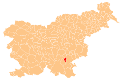
 Vavta Vas Location in Slovenia | |
| Coordinates: 45°46′40.11″N 15°4′49.75″E / 45.7778083°N 15.0804861°ECoordinates: 45°46′40.11″N 15°4′49.75″E / 45.7778083°N 15.0804861°E | |
| Country |
|
| Traditional region | Lower Carniola |
| Statistical region | Southeast Slovenia |
| Municipality | Straža |
| Area | |
| • Total | 2.56 km2 (0.99 sq mi) |
| Elevation | 179.9 m (590.2 ft) |
| Population (2002) | |
| • Total | 392 |
| [1] | |
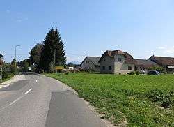
Vavta Vas (pronounced [ˈʋaːu̯ta ˈʋaːs]; Slovene: Vavta vas) is a village on the right bank of the Krka River in the Municipality of Straža in southeastern Slovenia. The area is part of the historical region of Lower Carniola. The municipality is now included in the Southeast Slovenia Statistical Region.[2]
Name
Vavta Vas was attested in written sources in 1436 as Walpottendorff (and as Waltendorf in 1449 and Waltensdorf in 1465). The medieval names indicate that the Slovene name is derived from *Valpťa vas, literally 'reeve's village', from the Slovene common noun valpot 'chief steward at a manor' (borrowed from Old High German waltboto 'ruler's deputy'). Compare also Vavpča vas.[3]
Church
The local parish church is dedicated to Saint James (Slovene: sveti Jakob) and belongs to the Roman Catholic Diocese of Novo Mesto. It was built in the 18th century on the site of a medieval predecessor.[4]
References
- ↑ Statistical Office of the Republic of Slovenia
- ↑ Straža municipal site
- ↑ Snoj, Marko. 2009. Etimološki slovar slovenskih zemljepisnih imen. Ljubljana: Modrijan and Založba ZRC, p. 450.
- ↑ "EŠD 2629". Registry of Immovable Cultural Heritage (in Slovenian). Ministry of Culture of the Republic of Slovenia. Retrieved 18 March 2011.
External links

- Vavta Vas at Geopedia
| Settlements | Administrative centre: Straža
|  | ||||
|---|---|---|---|---|---|---|